 |
|
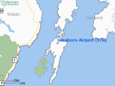
Location & QuickFacts
| FAA Information Effective: | 2008-09-25 |
| Airport Identifier: | 57B |
| Airport Status: | Operational |
| Longitude/Latitude: | 068-54-38.1000W/44-18-08.9000N
-68.910583/44.302472 (Estimated) |
| Elevation: | 92 ft / 28.04 m (Surveyed) |
| Land: | 41 acres |
| From nearest city: | 1 nautical miles W of Islesboro, ME |
| Location: | Waldo County, ME |
| Magnetic Variation: | 18W (1985) |
Owner & Manager
| Ownership: | Publicly owned |
| Owner: | Town Of Islesboro |
| Address: | P.o. Box 76
Isleboro, ME 04848 |
| Phone number: | 207-734-2253 |
| Manager: | Marnie Diffin
TOWN MANAGER OF ISLEBORO |
| Address: | P.o. Box 76
Islesboro, ME 04848 |
| Phone number: | 207-734-2253 |
Airport Operations and Facilities
| Airport Use: | Open to public |
| Wind indicator: | Yes |
| Segmented Circle: | No |
| Control Tower: | No |
| Landing fee charge: | No |
| Sectional chart: | Halifax |
| Region: | ANE - New England |
| Boundary ARTCC: | ZBW - Boston |
| Tie-in FSS: | BGR - Bangor |
| FSS on Airport: | No |
| FSS Toll Free: | 1-800-WX-BRIEF |
| NOTAMs Facility: | BGR (NOTAM-d service avaliable) |
| Federal Agreements: | NGY |
Airport Communications
Airport Services
| Airframe Repair: | NONE |
| Power Plant Repair: | NONE |
| Bulk Oxygen: | NONE |
Runway Information
Runway 01/19
| Dimension: | 2400 x 50 ft / 731.5 x 15.2 m |
| Surface: | ASPH, |
| |
Runway 01 |
Runway 19 |
| Longitude: | 068-54-34.6355W | 068-54-41.5850W |
| Latitude: | 44-17-57.2681N | 44-18-20.4309N |
| Elevation: | 71.00 ft | 88.00 ft |
| Traffic Pattern: | Left | Left |
| Markings: | Basic, Good Condition | Basic, Good Condition |
| Displaced threshold: | 250.00 ft | 0.00 ft |
| Runway End Identifier: | No | No |
| Centerline Lights: | No | No |
| Touchdown Lights: | No | No |
| Obstruction: | 30 ft trees, 230.0 ft from runway, 75 ft left of centerline, 1:1 slope to clear
RWY 01 APCH RATIO 9:1 TO DSPLCD THR.
20-30 FOOT TREES, 116-200 FEET OUT, 66 FEET RIGHT AND 75 FEET LEFT. | 38 ft trees, 615.0 ft from runway, 23 ft left of centerline, 10:1 slope to clear |
|
Radio Navigation Aids
| ID |
Type |
Name |
Ch |
Freq |
Var |
Dist |
| BST | NDB | Belfast | | 278.00 | 18W | 7.8 nm |
| SUH | NDB | Sprucehead | | 356.00 | 18W | 17.3 nm |
| BH | NDB | Surry | | 330.00 | 19W | 29.6 nm |
| BUP | NDB | Burnham | | 348.00 | 18W | 30.5 nm |
| RL | NDB | Bracy | | 399.00 | 18W | 36.7 nm |
| ISS | NDB | Wiscasset | | 407.00 | 18W | 36.9 nm |
| OLD | NDB | Old Town | | 272.00 | 20W | 44.0 nm |
| AUG | VOR/DME | Augusta | 051X | 111.40 | 18W | 38.1 nm |
| BGR | VORTAC | Bangor | 095X | 114.80 | 19W | 32.5 nm |
| BGR | VOT | Bangor | | 111.00 | | 30.5 nm |
Remarks
- ARPT CLSD NIGHTS.
- DEER ON & INVOF ARPT.
- DAYTIME USE ONLY.
- ARPT CLSD JANUARY THRU MARCH.
- VFR OPNS ONLY
Images and information placed above are from
http://www.airport-data.com/airport/57B/
We thank them for the data!
| General Info
|
| Country |
United States
|
| State |
MAINE
|
| FAA ID |
57B
|
| Latitude |
44-18-08.900N
|
| Longitude |
068-54-38.100W
|
| Elevation |
92 feet
|
| Near City |
ISLESBORO
|
We don't guarantee the information is fresh and accurate. The data may
be wrong or outdated.
For more up-to-date information please refer to other sources.
|
|


