 |
|
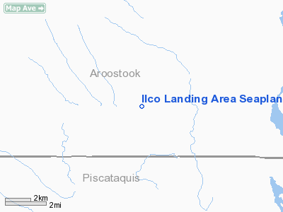
Ilco Landing Area Seaplane Base |
Location & QuickFacts
| FAA Information Effective: | 2008-09-25 |
| Airport Identifier: | ME04 |
| Airport Status: | Operational |
| Longitude/Latitude: | 069-31-50.2020W/46-36-34.1110N
-69.530612/46.609475 (Estimated) |
| Elevation: | 1031 ft / 314.25 m (Estimated) |
| Land: | 0 acres |
| From nearest city: | 0 nautical miles S of Clayton Lake, ME |
| Location: | Aroostook County, ME |
| Magnetic Variation: | 19W (1985) |
Owner & Manager
| Ownership: | Privately owned |
| Owner: | International Paper Company |
| Address: | 9 Green Street
Augusta, ME 04330 |
| Manager: | William Sylvester |
| Address: | Int'l Logng Corp 9 Green St.
Augusta, ME 04330 |
| Phone number: | 207-435-6128 |
Airport Operations and Facilities
| Airport Use: | Private |
| Wind indicator: | Yes |
| Segmented Circle: | No |
| Control Tower: | No |
| Landing fee charge: | No |
| Sectional chart: | Montreal |
| Region: | ANE - New England |
| Boundary ARTCC: | ZBW - Boston |
| Tie-in FSS: | BGR - Bangor |
| FSS on Airport: | No |
| FSS Toll Free: | 1-800-WX-BRIEF |
Airport Services
| Airframe Repair: | NONE |
| Power Plant Repair: | NONE |
Runway Information
Runway 10/28
| Dimension: | 2600 x 500 ft / 792.5 x 152.4 m |
| Surface: | WATER, |
| |
Runway 10 |
Runway 28 |
| Traffic Pattern: | Left | Left |
| Obstruction: | 50 ft trees, 1200.0 ft from runway, 24:1 slope to clear | 50 ft trees, 1000.0 ft from runway, 20:1 slope to clear |
|
Radio Navigation Aids
| ID |
Type |
Name |
Ch |
Freq |
Var |
Dist |
Remarks
Images and information placed above are from
http://www.airport-data.com/airport/ME04/
We thank them for the data!
| General Info
|
| Country |
United States
|
| State |
MAINE
|
| FAA ID |
ME04
|
| Latitude |
46-36-34.111N
|
| Longitude |
069-31-50.202W
|
| Elevation |
1031 feet
|
| Near City |
CLAYTON LAKE
|
We don't guarantee the information is fresh and accurate. The data may
be wrong or outdated.
For more up-to-date information please refer to other sources.
|
|


