 |
|
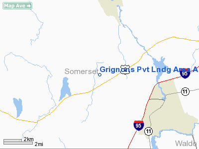
Grignons Pvt Lndg Area Airport |
Location & QuickFacts
| FAA Information Effective: | 2008-09-25 |
| Airport Identifier: | ME62 |
| Airport Status: | Operational |
| Longitude/Latitude: | 069-28-23.1720W/44-48-35.2230N
-69.473103/44.809784 (Estimated) |
| Elevation: | 390 ft / 118.87 m (Estimated) |
| Land: | 0 acres |
| From nearest city: | 1 nautical miles NE of West Pittsfield, ME |
| Location: | Somerset County, ME |
| Magnetic Variation: | 18W (1985) |
Owner & Manager
| Ownership: | Privately owned |
| Address: |
|
| Manager: | Arthur J Grignon |
| Address: | Rfd 1,
Pittsfield, ME 04967 |
| Phone number: | 207-474-7895 |
Airport Operations and Facilities
| Airport Use: | Private |
| Wind indicator: | Yes |
| Segmented Circle: | No |
| Control Tower: | No |
| Landing fee charge: | No |
| Sectional chart: | Montreal |
| Region: | ANE - New England |
| Boundary ARTCC: | ZBW - Boston |
| Tie-in FSS: | BGR - Bangor |
| FSS on Airport: | No |
| FSS Toll Free: | 1-800-WX-BRIEF |
Airport Services
| Fuel available: | 80 |
| Airframe Repair: | NONE |
| Power Plant Repair: | NONE |
Runway Information
Runway N/S
| Dimension: | 2500 x 100 ft / 762.0 x 30.5 m |
| Surface: | TURF, |
| |
Runway N |
Runway S |
| Traffic Pattern: | Left | Left |
|
Radio Navigation Aids
| ID |
Type |
Name |
Ch |
Freq |
Var |
Dist |
| BUP | NDB | Burnham | | 348.00 | 18W | 8.4 nm |
| RL | NDB | Bracy | | 399.00 | 18W | 23.8 nm |
| BST | NDB | Belfast | | 278.00 | 18W | 31.1 nm |
| OLD | NDB | Old Town | | 272.00 | 20W | 37.7 nm |
| XQA | NDB | Squaw | | 236.00 | 18W | 43.6 nm |
| SUH | NDB | Sprucehead | | 356.00 | 18W | 48.3 nm |
| AUG | VOR/DME | Augusta | 051X | 111.40 | 18W | 32.5 nm |
| BGR | VORTAC | Bangor | 095X | 114.80 | 19W | 25.6 nm |
| BGR | VOT | Bangor | | 111.00 | | 28.3 nm |
Remarks
- FILED FOR RECORD PURPOSES ONLY.
Images and information placed above are from
http://www.airport-data.com/airport/ME62/
We thank them for the data!
| General Info
|
| Country |
United States
|
| State |
MAINE
|
| FAA ID |
ME62
|
| Latitude |
44-48-35.223N
|
| Longitude |
069-28-23.172W
|
| Elevation |
390 feet
|
| Near City |
WEST PITTSFIELD
|
We don't guarantee the information is fresh and accurate. The data may
be wrong or outdated.
For more up-to-date information please refer to other sources.
|
|


