 |
|
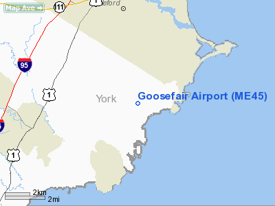
Location & QuickFacts
| FAA Information Effective: | 2008-09-25 |
| Airport Identifier: | ME45 |
| Airport Status: | Operational |
| Longitude/Latitude: | 070-25-56.1810W/43-24-20.3080N
-70.432272/43.405641 (Estimated) |
| Elevation: | 40 ft / 12.19 m (Estimated) |
| Land: | 0 acres |
| From nearest city: | 3 nautical miles NE of Kennebunkport, ME |
| Location: | York County, ME |
| Magnetic Variation: | 17W (1985) |
Owner & Manager
| Ownership: | Privately owned |
| Owner: | David L Burnham |
| Address: | Rfd 2 Box 939
Kennebunkport, ME 04046 |
| Phone number: | 207-967-2868 |
| Manager: | David L Burnham |
| Address: | Rfd 2 Box 939
Kennebunkport, ME 04046 |
| Phone number: | 207-967-2868 |
Airport Operations and Facilities
| Airport Use: | Private |
| Segmented Circle: | No |
| Control Tower: | No |
| Landing fee charge: | No |
| Sectional chart: | New York |
| Region: | ANE - New England |
| Boundary ARTCC: | ZBW - Boston |
| Tie-in FSS: | BGR - Bangor |
| FSS on Airport: | No |
| FSS Toll Free: | 1-800-WX-BRIEF |
Runway Information
Runway 14/32
| Dimension: | 1600 x 40 ft / 487.7 x 12.2 m |
| Surface: | GRVL, |
| |
Runway 14 |
Runway 32 |
| Traffic Pattern: | Left | Left |
| Obstruction: | | 30 ft trees, 250.0 ft from runway |
|
Radio Navigation Aids
| ID |
Type |
Name |
Ch |
Freq |
Var |
Dist |
| SZO | FAN MARKER | Grinn | | | 17W | 38.5 nm |
| LCI | FAN MARKER | Laconia | | | | 45.0 nm |
| PH | MARINE NDB | Portland Lhb-p | | 301.00 | 17W | 16.6 nm |
| ESG | NDB | Rollins | | 260.00 | 16W | 20.6 nm |
| SZO | NDB | Sebago | | 227.00 | 17W | 33.6 nm |
| CO | NDB | Epsom | | 216.00 | 16W | 47.9 nm |
| LC | NDB | Blnap | | 328.00 | 16W | 48.8 nm |
| ISS | NDB | Wiscasset | | 407.00 | 18W | 48.9 nm |
| NHZ | TACAN | Brunswick | 099X | | 17W | 35.8 nm |
| PSM | VOR/DME | Pease | 112X | 116.50 | 16W | 26.1 nm |
| LWM | VOR/DME | Lawrence | 072X | 112.50 | 15W | 49.4 nm |
| ENE | VORTAC | Kennebunk | 118X | 117.10 | 17W | 8.0 nm |
| PWM | VOT | Portland Intl Jetport | | 111.00 | | 15.1 nm |
Remarks
Images and information placed above are from
http://www.airport-data.com/airport/ME45/
We thank them for the data!
| General Info
|
| Country |
United States
|
| State |
MAINE
|
| FAA ID |
ME45
|
| Latitude |
43-24-20.308N
|
| Longitude |
070-25-56.181W
|
| Elevation |
40 feet
|
| Near City |
KENNEBUNKPORT
|
We don't guarantee the information is fresh and accurate. The data may
be wrong or outdated.
For more up-to-date information please refer to other sources.
|
|


