 |
|
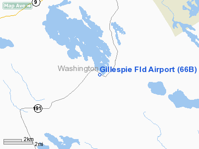
Location & QuickFacts
| FAA Information Effective: | 2008-09-25 |
| Airport Identifier: | 66B |
| Airport Status: | Operational |
| Longitude/Latitude: | 067-20-57.9680W/45-02-00.2740N
-67.349436/45.033409 (Estimated) |
| Elevation: | 200 ft / 60.96 m (Estimated) |
| Land: | 60 acres |
| From nearest city: | 1 nautical miles W of Meddybemps, ME |
| Location: | Washington County, ME |
| Magnetic Variation: | 20W (1985) |
Owner & Manager
| Ownership: | Privately owned |
| Owner: | Bruce Bailey |
| Address: | 1018 Main Street
Meddybemps, ME 04657 |
| Phone number: | 207-454-1318 |
| Manager: | Bruce Bailey |
| Address: | 1018 Main Street, Box 105
Meddybemps, ME 04657 |
| Phone number: | 207-454-1318 |
Airport Operations and Facilities
| Airport Use: | Open to public |
| Wind indicator: | Yes |
| Segmented Circle: | No |
| Control Tower: | No |
| Landing fee charge: | No |
| Sectional chart: | Halifax |
| Region: | ANE - New England |
| Boundary ARTCC: | ZBW - Boston |
| Tie-in FSS: | BGR - Bangor |
| FSS on Airport: | No |
| FSS Toll Free: | 1-800-WX-BRIEF |
| NOTAMs Facility: | BGR (NOTAM-d service avaliable) |
Airport Communications
Airport Services
| Airframe Repair: | NONE |
| Power Plant Repair: | NONE |
Runway Information
Runway 16/34
| Dimension: | 1635 x 50 ft / 498.3 x 15.2 m |
| Surface: | TURF, Fair Condition |
| |
Runway 16 |
Runway 34 |
| Traffic Pattern: | Left | Left |
| Obstruction: | 25 ft trees, 70 ft right of centerline | 25 ft trees, 0.0 ft from runway, 85L/ ft right of centerline |
|
Radio Navigation Aids
| ID |
Type |
Name |
Ch |
Freq |
Var |
Dist |
| EPM | NDB | Eastport | | 260.00 | 19W | 16.1 nm |
| MVM | NDB | Machias | | 251.00 | 19W | 20.5 nm |
| PNN | VOR/DME | Princeton | 090X | 114.30 | 21W | 23.3 nm |
Remarks
- RWY NOT PLOWED WINTER MONTHS.
- 36 FT PLINE 280 FT NORTH OF RY 16 .
- VFR OPERNS ONLY
Images and information placed above are from
http://www.airport-data.com/airport/66B/
We thank them for the data!
| General Info
|
| Country |
United States
|
| State |
MAINE
|
| FAA ID |
66B
|
| Latitude |
45-02-00.274N
|
| Longitude |
067-20-57.968W
|
| Elevation |
200 feet
|
| Near City |
MEDDYBEMPS
|
We don't guarantee the information is fresh and accurate. The data may
be wrong or outdated.
For more up-to-date information please refer to other sources.
|
|


