 |
|
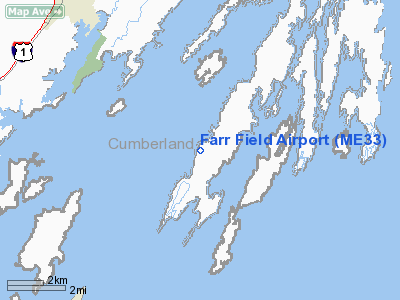
Location & QuickFacts
| FAA Information Effective: | 2008-09-25 |
| Airport Identifier: | ME33 |
| Airport Status: | Operational |
| Longitude/Latitude: | 070-00-47.1720W/43-46-43.2970N
-70.013103/43.778694 (Estimated) |
| Elevation: | 70 ft / 21.34 m (Estimated) |
| Land: | 0 acres |
| From nearest city: | 2 nautical miles SW of Harpswell, ME |
| Location: | Cumberland County, ME |
| Magnetic Variation: | 17W (1985) |
Owner & Manager
| Ownership: | Privately owned |
| Owner: | J. Lloyd Thompson |
| Address: | 90 Thompson Rd.
South Harpswell, ME 04079 |
| Phone number: | 207-833-2924 |
| Manager: | J. Lloyd Thompson |
| Address: | 90 Thompson Rd.
South Harpswell, ME 04079 |
| Phone number: | 207-833-2924 |
Airport Operations and Facilities
| Airport Use: | Private |
| Wind indicator: | No |
| Segmented Circle: | No |
| Control Tower: | No |
| Landing fee charge: | No |
| Sectional chart: | New York |
| Region: | ANE - New England |
| Boundary ARTCC: | ZBW - Boston |
| Tie-in FSS: | BGR - Bangor |
| FSS on Airport: | No |
| FSS Toll Free: | 1-800-WX-BRIEF |
Airport Services
| Airframe Repair: | NONE |
| Power Plant Repair: | NONE |
Runway Information
Runway 14/32
| Dimension: | 1900 x 100 ft / 579.1 x 30.5 m |
| Surface: | TURF, |
| |
Runway 14 |
Runway 32 |
| Traffic Pattern: | Left | Left |
| Obstruction: | | 25 ft , 25.0 ft from runway |
|
Radio Navigation Aids
| ID |
Type |
Name |
Ch |
Freq |
Var |
Dist |
| SZO | FAN MARKER | Grinn | | | 17W | 39.1 nm |
| PH | MARINE NDB | Portland Lhb-p | | 301.00 | 17W | 15.5 nm |
| ISS | NDB | Wiscasset | | 407.00 | 18W | 20.3 nm |
| SZO | NDB | Sebago | | 227.00 | 17W | 34.2 nm |
| SUH | NDB | Sprucehead | | 356.00 | 18W | 42.6 nm |
| RL | NDB | Bracy | | 399.00 | 18W | 42.7 nm |
| ESG | NDB | Rollins | | 260.00 | 16W | 48.9 nm |
| NHZ | TACAN | Brunswick | 099X | | 17W | 6.9 nm |
| AUG | VOR/DME | Augusta | 051X | 111.40 | 18W | 33.9 nm |
| ENE | VORTAC | Kennebunk | 118X | 117.10 | 17W | 33.7 nm |
| PWM | VOT | Portland Intl Jetport | | 111.00 | | 15.5 nm |
Remarks
- RWY SUBJ TO FROST ACTION SPRING & WINTER. SNOW PLOWED SOMETIMES - CHECK FSS.
- RWY ABOUT 30' HIGHER ON EASTERLY END.
- VFR ONLY.
Images and information placed above are from
http://www.airport-data.com/airport/ME33/
We thank them for the data!
| General Info
|
| Country |
United States
|
| State |
MAINE
|
| FAA ID |
ME33
|
| Latitude |
43-46-43.297N
|
| Longitude |
070-00-47.172W
|
| Elevation |
70 feet
|
| Near City |
HARPSWELL
|
We don't guarantee the information is fresh and accurate. The data may
be wrong or outdated.
For more up-to-date information please refer to other sources.
|
|


