 |
|
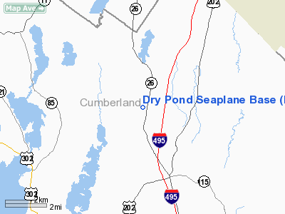
Location & QuickFacts
| FAA Information Effective: | 2008-09-25 |
| Airport Identifier: | ME80 |
| Airport Status: | Operational |
| Longitude/Latitude: | 070-21-23.0000W/43-56-02.0000N
-70.356389/43.933889 (Estimated) |
| Elevation: | 309 ft / 94.18 m (Estimated) |
| Land: | 0 acres |
| From nearest city: | 3 nautical miles N of Gray, ME |
| Location: | Cumberland County, ME |
| Magnetic Variation: | 17W (1990) |
Owner & Manager
| Ownership: | Privately owned |
| Owner: | Richard L Knight |
| Address: | 353 Mountfort Rd
North Yarmouth, ME 04097 |
| Phone number: | 207-846-4520 |
| Manager: | Richard L Knight |
| Address: | 353 Mountfort Rd
North Yarmouth, ME 04097 |
| Phone number: | 207-846-4520 |
Airport Operations and Facilities
| Airport Use: | Private |
| Segmented Circle: | No |
| Control Tower: | No |
| Sectional chart: | New York |
| Region: | ANE - New England |
| Boundary ARTCC: | ZBW - Boston |
| Tie-in FSS: | BGR - Bangor |
| FSS on Airport: | No |
| FSS Toll Free: | 1-800-WX-BRIEF |
Runway Information
Runway 01/19
| Dimension: | 3500 x 1000 ft / 1066.8 x 304.8 m |
| Surface: | WATER, |
| |
Runway 01 |
Runway 19 |
| Traffic Pattern: | Left | Left |
|
Radio Navigation Aids
| ID |
Type |
Name |
Ch |
Freq |
Var |
Dist |
| SZO | FAN MARKER | Grinn | | | 17W | 22.8 nm |
| PH | MARINE NDB | Portland Lhb-p | | 301.00 | 17W | 27.0 nm |
| SZO | NDB | Sebago | | 227.00 | 17W | 18.5 nm |
| ISS | NDB | Wiscasset | | 407.00 | 18W | 31.1 nm |
| RL | NDB | Bracy | | 399.00 | 18W | 41.5 nm |
| ESG | NDB | Rollins | | 260.00 | 16W | 47.6 nm |
| NHZ | TACAN | Brunswick | 099X | | 17W | 19.2 nm |
| AUG | VOR/DME | Augusta | 051X | 111.40 | 18W | 33.5 nm |
| ENE | VORTAC | Kennebunk | 118X | 117.10 | 17W | 32.5 nm |
| PWM | VOT | Portland Intl Jetport | | 111.00 | | 17.6 nm |
Remarks
- PRVDD OPS ARE CONDUCTED RUING DAY TIME VFR WEATHER CONDITIONS.
Images and information placed above are from
http://www.airport-data.com/airport/ME80/
We thank them for the data!
| General Info
|
| Country |
United States
|
| State |
MAINE
|
| FAA ID |
ME80
|
| Latitude |
43-56-02.000N
|
| Longitude |
070-21-23.000W
|
| Elevation |
309 feet
|
| Near City |
GRAY
|
We don't guarantee the information is fresh and accurate. The data may
be wrong or outdated.
For more up-to-date information please refer to other sources.
|
|


