 |
|
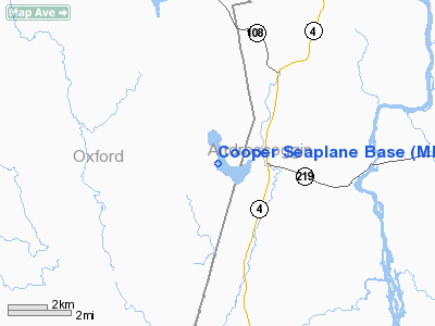
Location & QuickFacts
| FAA Information Effective: | 2008-09-25 |
| Airport Identifier: | ME11 |
| Airport Status: | Operational |
| Longitude/Latitude: | 070-17-16.2080W/44-20-32.2440N
-70.287836/44.342290 (Estimated) |
| Elevation: | 373 ft / 113.69 m (Estimated) |
| Land: | 0 acres |
| From nearest city: | 3 nautical miles E of Hartford, ME |
| Location: | Oxford County, ME |
| Magnetic Variation: | 17W (1985) |
Owner & Manager
| Ownership: | Privately owned |
| Owner: | Michael D. Cooper |
| Address: | Po Box 552
N. Turner, ME 04266 |
| Phone number: | 207-224-7950 |
| Manager: | Michael D. Cooper |
| Address: | Po Box 552
N. Turner, ME 04266 |
| Phone number: | 207-224-7950 |
Airport Operations and Facilities
| Airport Use: | Private |
| Wind indicator: | Yes |
| Segmented Circle: | No |
| Control Tower: | No |
| Sectional chart: | Montreal |
| Region: | ANE - New England |
| Boundary ARTCC: | ZBW - Boston |
| Tie-in FSS: | BGR - Bangor |
| FSS Toll Free: | 1-800-WX-BRIEF |
Runway Information
Runway 05W/23W
| Dimension: | 3000 x 500 ft / 914.4 x 152.4 m |
| Surface: | WATER, |
| |
Runway 05W |
Runway 23W |
| Traffic Pattern: | Left | Left |
| Obstruction: | 40 ft trees, 800.0 ft from runway, 20:1 slope to clear | 40 ft trees, 800.0 ft from runway, 20:1 slope to clear |
|
Runway 16W/34W
| Dimension: | 4000 x 500 ft / 1219.2 x 152.4 m |
| Surface: | WATER, |
| |
Runway 16W |
Runway 34W |
| Traffic Pattern: | Left | Left |
|
Radio Navigation Aids
| ID |
Type |
Name |
Ch |
Freq |
Var |
Dist |
| SZO | FAN MARKER | Grinn | | | 17W | 34.5 nm |
| PH | MARINE NDB | Portland Lhb-p | | 301.00 | 17W | 49.7 nm |
| RL | NDB | Bracy | | 399.00 | 18W | 24.8 nm |
| SZO | NDB | Sebago | | 227.00 | 17W | 33.9 nm |
| ISS | NDB | Wiscasset | | 407.00 | 18W | 35.3 nm |
| RQM | NDB | Rangeley | | 221.00 | 18W | 40.7 nm |
| HXK | NDB | Hornebrook | | 281.00 | 17W | 40.8 nm |
| BUP | NDB | Burnham | | 348.00 | 18W | 45.2 nm |
| NHZ | TACAN | Brunswick | 099X | | 17W | 32.3 nm |
| AUG | VOR/DME | Augusta | 051X | 111.40 | 18W | 21.2 nm |
| BML | VOR/DME | Berlin | 041X | 110.40 | 17W | 42.3 nm |
| PWM | VOT | Portland Intl Jetport | | 111.00 | | 42.1 nm |
Remarks
Images and information placed above are from
http://www.airport-data.com/airport/ME11/
We thank them for the data!
| General Info
|
| Country |
United States
|
| State |
MAINE
|
| FAA ID |
ME11
|
| Latitude |
44-20-32.244N
|
| Longitude |
070-17-16.208W
|
| Elevation |
373 feet
|
| Near City |
HARTFORD
|
We don't guarantee the information is fresh and accurate. The data may
be wrong or outdated.
For more up-to-date information please refer to other sources.
|
|


