 |
|
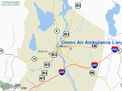
Cmmc Air Ambulance Landing Site Heliport |
Location & QuickFacts
| FAA Information Effective: | 2008-09-25 |
| Airport Identifier: | ME95 |
| Airport Status: | Operational |
| Longitude/Latitude: | 070-12-55.1900W/44-06-11.2600N
-70.215331/44.103128 (Estimated) |
| Elevation: | 241 ft / 73.46 m (Estimated) |
| Land: | 0 acres |
| From nearest city: | 0 nautical miles of Lewiston, ME |
| Location: | Androscoggin County, ME |
| Magnetic Variation: | 17W (1995) |
Owner & Manager
| Ownership: | Privately owned |
| Owner: | Central Maine Medical Ctr |
| Address: | 300 Main St
Lewiston, ME 04240 |
| Phone number: | 207-795-2715 |
| Manager: | Jack May |
| Address: | , 300 Main St
Lewiston, ME 04240 |
| Phone number: | 207-795-2715 |
Airport Operations and Facilities
| Airport Use: | Private |
| Segmented Circle: | No |
| Control Tower: | No |
| Lighting Schedule: | ON CALL
FOR PERIMETER & FLOOD LGTS, CALL 207-795-2715. |
| Sectional chart: | Montreal |
| Region: | ANE - New England |
| Boundary ARTCC: | ZBW - Boston |
| Tie-in FSS: | BGR - Bangor |
| FSS Toll Free: | 1-800-WX-BRIEF |
Runway Information
Helipad H1
| Dimension: | 40 x 40 ft / 12.2 x 12.2 m |
| Surface: | CONC, |
| |
Runway H1 |
Runway |
| Traffic Pattern: | Left | Left |
|
Radio Navigation Aids
| ID |
Type |
Name |
Ch |
Freq |
Var |
Dist |
| SZO | FAN MARKER | Grinn | | | 17W | 30.1 nm |
| PH | MARINE NDB | Portland Lhb-p | | 301.00 | 17W | 35.0 nm |
| ISS | NDB | Wiscasset | | 407.00 | 18W | 25.9 nm |
| SZO | NDB | Sebago | | 227.00 | 17W | 27.3 nm |
| RL | NDB | Bracy | | 399.00 | 18W | 29.8 nm |
| SUH | NDB | Sprucehead | | 356.00 | 18W | 48.1 nm |
| NHZ | TACAN | Brunswick | 099X | | 17W | 18.7 nm |
| AUG | VOR/DME | Augusta | 051X | 111.40 | 18W | 22.3 nm |
| ENE | VORTAC | Kennebunk | 118X | 117.10 | 17W | 44.2 nm |
| PWM | VOT | Portland Intl Jetport | | 111.00 | | 28.1 nm |
Remarks
- MEDICAL USE.
- PRVDD INGRESS/EGRESS ROUTES ALONG ANDROSCOGGIN RIVER & AVOID SCHOOLS; VFR USE; ALL USERS ADVISED OF CONDITIONS.
Images and information placed above are from
http://www.airport-data.com/airport/ME95/
We thank them for the data!
| General Info
|
| Country |
United States
|
| State |
MAINE
|
| FAA ID |
ME95
|
| Latitude |
44-06-11.260N
|
| Longitude |
070-12-55.190W
|
| Elevation |
241 feet
|
| Near City |
LEWISTON
|
We don't guarantee the information is fresh and accurate. The data may
be wrong or outdated.
For more up-to-date information please refer to other sources.
|
|


