 |
|
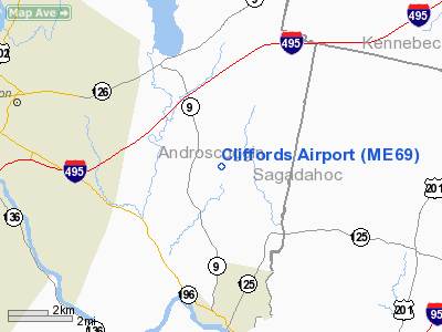
Location & QuickFacts
| FAA Information Effective: | 2008-09-25 |
| Airport Identifier: | ME69 |
| Airport Status: | Operational |
| Longitude/Latitude: | 070-03-52.1890W/44-04-08.2710N
-70.064497/44.068964 (Estimated) |
| Elevation: | 280 ft / 85.34 m (Estimated) |
| Land: | 16 acres |
| From nearest city: | 4 nautical miles SE of Sabattus, ME |
| Location: | Androscoggin County, ME |
| Magnetic Variation: | 17W (1990) |
Owner & Manager
| Ownership: | Privately owned |
| Owner: | Leland Clifford |
| Address: | Rfd 2 Box 3530
Sabattus, ME 04280 |
| Phone number: | 207-375-4820 |
| Manager: | Leland Clifford |
| Address: | Rfd 2 Box 3530
Sabattus, ME 04280 |
| Phone number: | 207-375-4820 |
Airport Operations and Facilities
| Airport Use: | Private |
| Wind indicator: | Yes |
| Segmented Circle: | No |
| Control Tower: | No |
| Sectional chart: | Montreal |
| Region: | ANE - New England |
| Boundary ARTCC: | ZBW - Boston |
| Tie-in FSS: | BGR - Bangor |
| FSS on Airport: | No |
| FSS Toll Free: | 1-800-WX-BRIEF |
Runway Information
Runway 03/21
| Dimension: | 1680 x 50 ft / 512.1 x 15.2 m |
| Surface: | TURF-GRVL, |
| |
Runway 03 |
Runway 21 |
| Traffic Pattern: | Left | Left |
| Obstruction: | 40 ft trees | 50 ft plines, 0.0 ft from runway |
|
Radio Navigation Aids
| ID |
Type |
Name |
Ch |
Freq |
Var |
Dist |
| SZO | FAN MARKER | Grinn | | | 17W | 36.0 nm |
| PH | MARINE NDB | Portland Lhb-p | | 301.00 | 17W | 32.6 nm |
| ISS | NDB | Wiscasset | | 407.00 | 18W | 19.1 nm |
| RL | NDB | Bracy | | 399.00 | 18W | 27.5 nm |
| SZO | NDB | Sebago | | 227.00 | 17W | 32.6 nm |
| SUH | NDB | Sprucehead | | 356.00 | 18W | 41.5 nm |
| BUP | NDB | Burnham | | 348.00 | 18W | 48.5 nm |
| BST | NDB | Belfast | | 278.00 | 18W | 49.8 nm |
| NHZ | TACAN | Brunswick | 099X | | 17W | 13.3 nm |
| AUG | VOR/DME | Augusta | 051X | 111.40 | 18W | 19.0 nm |
| ENE | VORTAC | Kennebunk | 118X | 117.10 | 17W | 45.4 nm |
| PWM | VOT | Portland Intl Jetport | | 111.00 | | 27.9 nm |
Remarks
Images and information placed above are from
http://www.airport-data.com/airport/ME69/
We thank them for the data!
| General Info
|
| Country |
United States
|
| State |
MAINE
|
| FAA ID |
ME69
|
| Latitude |
44-04-08.271N
|
| Longitude |
070-03-52.189W
|
| Elevation |
280 feet
|
| Near City |
SABATTUS
|
We don't guarantee the information is fresh and accurate. The data may
be wrong or outdated.
For more up-to-date information please refer to other sources.
|
|


