 |
|
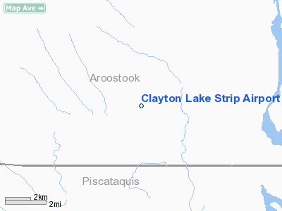
Clayton Lake Strip Airport |
Location & QuickFacts
| FAA Information Effective: | 2008-09-25 |
| Airport Identifier: | ME19 |
| Airport Status: | Operational |
| Longitude/Latitude: | 069-31-20.2010W/46-36-58.1110N
-69.522278/46.616142 (Estimated) |
| Elevation: | 1150 ft / 350.52 m (Estimated) |
| Land: | 0 acres |
| From nearest city: | 5 nautical miles N of Clayton Lake, ME |
| Location: | Aroostook County, ME |
| Magnetic Variation: | 20W (1985) |
Owner & Manager
| Ownership: | Privately owned |
| Owner: | Tall Timber Llc |
| Address: | 5086 Us Route 5 Suite 2
Newport, VT 05855 |
| Phone number: | 802-334-8402 |
| Manager: | Tall Timber Llc |
| Address: | 5086 Us Route 5 Suite 2
Newport, VT 05855 |
| Phone number: | 802-334-8402 |
Airport Operations and Facilities
| Airport Use: | Private |
| Wind indicator: | Yes |
| Segmented Circle: | No |
| Control Tower: | No |
| Landing fee charge: | No |
| Sectional chart: | Montreal |
| Region: | ANE - New England |
| Boundary ARTCC: | ZBW - Boston |
| Tie-in FSS: | BGR - Bangor |
| FSS on Airport: | No |
| FSS Toll Free: | 1-800-WX-BRIEF |
Airport Services
| Airframe Repair: | NONE |
| Power Plant Repair: | NONE |
Runway Information
Runway E/W
| Dimension: | 1200 x 100 ft / 365.8 x 30.5 m |
| Surface: | TURF, |
| |
Runway E |
Runway W |
| Traffic Pattern: | Left | Left |
| Obstruction: | 50 ft trees, 300.0 ft from runway | |
|
Radio Navigation Aids
| ID |
Type |
Name |
Ch |
Freq |
Var |
Dist |
Remarks
- EMERGENCY ONLY.
- RY MAY BE SOFT SPRING & FALL; MAY NOTBE PLOWED WINTER MONTHS.
- VFR ONLY
Images and information placed above are from
http://www.airport-data.com/airport/ME19/
We thank them for the data!
| General Info
|
| Country |
United States
|
| State |
MAINE
|
| FAA ID |
ME19
|
| Latitude |
46-36-58.111N
|
| Longitude |
069-31-20.201W
|
| Elevation |
1150 feet
|
| Near City |
CLAYTON LAKE
|
We don't guarantee the information is fresh and accurate. The data may
be wrong or outdated.
For more up-to-date information please refer to other sources.
|
|


