 |
|
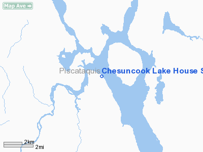
Chesuncook Lake House Seaplane Base |
Location & QuickFacts
| FAA Information Effective: | 2008-09-25 |
| Airport Identifier: | 1ME |
| Airport Status: | Operational |
| Longitude/Latitude: | 069-24-34.0000W/46-03-39.1500N
-69.409444/46.060875 (Estimated) |
| Elevation: | 942 ft / 287.12 m (Estimated) |
| Land: | 0 acres |
| From nearest city: | 0 nautical miles N of Chesuncook, ME |
| Location: | Piscataquis County, ME |
| Magnetic Variation: | () |
Owner & Manager
| Ownership: | Privately owned |
| Owner: | Chesuncook Lake House |
| Address: | Hc76 Box 656 Chesuncook Village
Greenville, ME 04441 |
| Phone number: | 207-745-5330 |
| Manager: | David Surprenant |
| Address: | Hc 76 Box 656 Chesuncook Village
Greenville, ME 04441 |
| Phone number: | 207-745-5330 |
Airport Operations and Facilities
| Airport Use: | Open to public |
| Control Tower: | No |
| Sectional chart: | Montreal |
| Region: | ANE - New England |
| Boundary ARTCC: | ZBW - Boston |
| Tie-in FSS: | BGR - Bangor |
| FSS Toll Free: | 1-800-WX-BRIEF |
Airport Communications
Runway Information
Runway ALL/WAY
| Dimension: | 15000 x 1100 ft / 4572.0 x 335.3 m |
| Surface: | WATER, |
| |
Runway ALL |
Runway WAY |
| Traffic Pattern: | Left | Left |
|
Radio Navigation Aids
| ID |
Type |
Name |
Ch |
Freq |
Var |
Dist |
| XQA | NDB | Squaw | | 236.00 | 18W | 34.3 nm |
| LNT | NDB | Milnot | | 344.00 | 19W | 43.7 nm |
| MLT | VOR/DME | Millinocket | 126X | 117.90 | 20W | 47.1 nm |
Remarks
- FUEL AVBL ONLY IN EMERGENCY.
- PRVDD DAYTIME VFR OPNS ONLY, & RESOLVE ANY TRAFFIC PATTERN CONFLICTS WITH ANY ARPTS WITHIN 5 NM.
Images and information placed above are from
http://www.airport-data.com/airport/1ME/
We thank them for the data!
We don't guarantee the information is fresh and accurate. The data may
be wrong or outdated.
For more up-to-date information please refer to other sources.
|
|


