 |
|
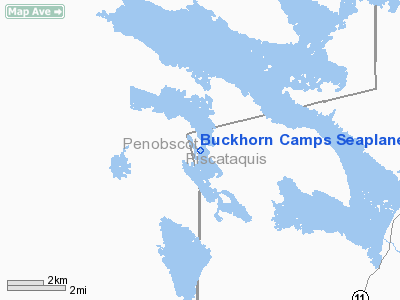
Buckhorn Camps Seaplane Base |
Location & QuickFacts
| FAA Information Effective: | 2008-09-25 |
| Airport Identifier: | 78B |
| Airport Status: | Operational |
| Longitude/Latitude: | 068-56-58.1560W/45-39-15.1710N
-68.949488/45.654214 (Estimated) |
| Elevation: | 500 ft / 152.40 m (Estimated) |
| Land: | 0 acres |
| From nearest city: | 0 nautical miles NE of Norcross/millinocket/, ME |
| Location: | Penobscot County, ME |
| Magnetic Variation: | 19W (1985) |
Owner & Manager
| Ownership: | Privately owned |
| Owner: | Greg Pellegrini |
| Address: | 80 Paine Street
Uxbridge, MA 01569 |
| Phone number: | 508-400-6274 |
| Manager: | Greg Pellegrini |
| Address: | 80 Paine Street
Uxbridge, MA 01569 |
| Phone number: | 508-400-6274 |
Airport Operations and Facilities
| Airport Use: | Open to public |
| Wind indicator: | No |
| Segmented Circle: | No |
| Control Tower: | No |
| Landing fee charge: | No |
| Sectional chart: | Halifax |
| Region: | ANE - New England |
| Boundary ARTCC: | ZBW - Boston |
| Tie-in FSS: | BGR - Bangor |
| FSS on Airport: | No |
| FSS Toll Free: | 1-800-WX-BRIEF |
| NOTAMs Facility: | BGR (NOTAM-d service avaliable) |
Airport Communications
Airport Services
| Airframe Repair: | NONE |
| Power Plant Repair: | NONE |
Runway Information
Runway E/W
| Dimension: | 3000 x 500 ft / 914.4 x 152.4 m |
| Surface: | WATER, |
| |
Runway E |
Runway W |
| Traffic Pattern: | Left | Left |
| Runway End Identifier: | No | No |
| Centerline Lights: | No | No |
| Touchdown Lights: | No | No |
| Obstruction: | 60 ft trees, 1200.0 ft from runway, 100 ft right of centerline, 20:1 slope to clear | 60 ft trees, 1200.0 ft from runway, 100 ft right of centerline, 20:1 slope to clear |
|
Runway NW/SE
| Dimension: | 4000 x 500 ft / 1219.2 x 152.4 m |
| Surface: | WATER, |
| |
Runway NW |
Runway SE |
| Traffic Pattern: | Left | Left |
| Obstruction: | 60 ft trees, 1200.0 ft from runway, 100 ft left of centerline, 20:1 slope to clear | 60 ft trees, 1200.0 ft from runway, 125 ft right of centerline, 20:1 slope to clear |
|
Radio Navigation Aids
| ID |
Type |
Name |
Ch |
Freq |
Var |
Dist |
| LNT | NDB | Milnot | | 344.00 | 19W | 16.8 nm |
| LRG | NDB | Lincoln | | 216.00 | 19W | 24.9 nm |
| XQA | NDB | Squaw | | 236.00 | 18W | 31.5 nm |
| OLD | NDB | Old Town | | 272.00 | 20W | 41.1 nm |
| MLT | VOR/DME | Millinocket | 126X | 117.90 | 20W | 18.7 nm |
| BGR | VORTAC | Bangor | 095X | 114.80 | 19W | 48.9 nm |
Remarks
- CTN: MANY SHALLOW ROCKY AREAS DURING LOW WATER CONDITIONS IN MIDDLE OF LAKE.
- EXISTED PRIOR TO 1959.
Images and information placed above are from
http://www.airport-data.com/airport/78B/
We thank them for the data!
| General Info
|
| Country |
United States
|
| State |
MAINE
|
| FAA ID |
78B
|
| Latitude |
45-39-15.171N
|
| Longitude |
068-56-58.156W
|
| Elevation |
500 feet
|
| Near City |
NORCROSS/MILLINOCKET/
|
We don't guarantee the information is fresh and accurate. The data may
be wrong or outdated.
For more up-to-date information please refer to other sources.
|
|


