 |
|
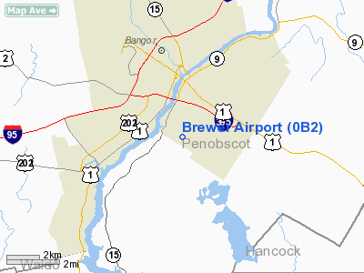
Location & QuickFacts
| FAA Information Effective: | 2008-09-25 |
| Airport Identifier: | 0B2 |
| Airport Status: | Operational |
| Longitude/Latitude: | 068-46-04.0000W/44-45-49.9000N
-68.767778/44.763861 (Estimated) |
| Elevation: | 124 ft / 37.80 m (Surveyed) |
| Land: | 75 acres |
| From nearest city: | 2 nautical miles S of Brewer, ME |
| Location: | Penobscot County, ME |
| Magnetic Variation: | 19W (1985) |
Owner & Manager
| Ownership: | Privately owned |
| Owner: | Brewer Airport Inc |
| Address: | 2420 Marshall Ct
Naperville, IL 60565 |
| Manager: | Brewer Airport, Inc
SEC/TREAS OF BREWER ARPT ASSOCIATION. |
| Address: | Po Box 12 Wiswell Rd
Brewer, ME 04412 |
| Phone number: | 207-989-6255 |
Airport Operations and Facilities
| Airport Use: | Open to public |
| Wind indicator: | Yes |
| Segmented Circle: | No |
| Control Tower: | No |
| Landing fee charge: | No |
| Sectional chart: | Halifax |
| Region: | ANE - New England |
| Boundary ARTCC: | ZBW - Boston |
| Tie-in FSS: | BGR - Bangor |
| FSS on Airport: | No |
| FSS Toll Free: | 1-800-WX-BRIEF |
| NOTAMs Facility: | BGR (NOTAM-d service avaliable) |
Airport Communications
Airport Services
| Bottled Oxygen: | NONE |
| Bulk Oxygen: | NONE |
Runway Information
Runway 01/19
| Dimension: | 1730 x 30 ft / 527.3 x 9.1 m |
| Surface: | TURF, Good Condition |
| |
Runway 01 |
Runway 19 |
| Longitude: | 068-46-01.5200W | 068-46-06.5100W |
| Latitude: | 44-45-41.5300N | 44-45-58.2500N |
| Traffic Pattern: | Right | Left |
| Obstruction: | 20 ft brush, 35 ft right of centerline | 20 ft tree, 0.0 ft from runway |
|
Radio Navigation Aids
| ID |
Type |
Name |
Ch |
Freq |
Var |
Dist |
| OLD | NDB | Old Town | | 272.00 | 20W | 15.7 nm |
| BST | NDB | Belfast | | 278.00 | 18W | 23.6 nm |
| BH | NDB | Surry | | 330.00 | 19W | 23.9 nm |
| BUP | NDB | Burnham | | 348.00 | 18W | 25.5 nm |
| LRG | NDB | Lincoln | | 216.00 | 19W | 36.9 nm |
| RL | NDB | Bracy | | 399.00 | 18W | 45.2 nm |
| SUH | NDB | Sprucehead | | 356.00 | 18W | 45.3 nm |
| BGR | VORTAC | Bangor | 095X | 114.80 | 19W | 6.5 nm |
| BGR | VOT | Bangor | | 111.00 | | 3.0 nm |
Remarks
- MAKE ALL APCH/DEPS TO E OF ARPT; USE GRVL STRIP ONLY; TURF AREA NOT MAINTD.
- +25 FT POWER LINE 460 FT N OF RY 19 END.
- OCCASIONAL SOFT MUD EITHER SIDE OF RWY.
- PUBLIC GOLFCOURSE AT EOR 01.
- RY 01/19 +20 FT TREES & BRUSH 30 FT FM CNTLN ALONG EAST SIDE.
- EXISTED PRIOR TO 1959.
Images and information placed above are from
http://www.airport-data.com/airport/0B2/
We thank them for the data!
| General Info
|
| Country |
United States
|
| State |
MAINE
|
| FAA ID |
0B2
|
| Latitude |
44-45-49.258N
|
| Longitude |
068-46-04.129W
|
| Elevation |
124 feet
|
| Near City |
BREWER
|
We don't guarantee the information is fresh and accurate. The data may
be wrong or outdated.
For more up-to-date information please refer to other sources.
|
|


