 |
|
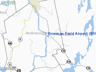
Location & QuickFacts
| FAA Information Effective: | 2008-09-25 |
| Airport Identifier: | B10 |
| Airport Status: | Operational |
| Longitude/Latitude: | 070-08-45.9000W/44-24-36.0000N
-70.146083/44.410000 (Estimated) |
| Elevation: | 327 ft / 99.67 m (Surveyed) |
| Land: | 20 acres |
| From nearest city: | 4 nautical miles SE of Livermore Falls, ME |
| Location: | Androscoggin County, ME |
| Magnetic Variation: | 18W (1985) |
Owner & Manager
| Ownership: | Privately owned |
| Owner: | Bowman Flying Club Inc |
| Address: | P O Box 238
E Livermore, ME 04228 |
| Manager: | Kenneth Lyman |
| Address: | 14 Lyman Lane
East Livermore Falls, ME 04228 |
| Phone number: | 207-897-5104 |
Airport Operations and Facilities
| Airport Use: | Open to public |
| Wind indicator: | Yes |
| Segmented Circle: | Yes |
| Control Tower: | No |
| Landing fee charge: | No |
| Sectional chart: | Montreal |
| Region: | ANE - New England |
| Traffic Pattern Alt: | 1350 ft |
| Boundary ARTCC: | ZBW - Boston |
| Tie-in FSS: | BGR - Bangor |
| FSS on Airport: | No |
| FSS Toll Free: | 1-800-WX-BRIEF |
| NOTAMs Facility: | BGR (NOTAM-d service avaliable) |
Airport Communications
Runway Information
Runway 02/20
| Dimension: | 2201 x 120 ft / 670.9 x 36.6 m |
| Surface: | TURF, Good Condition |
| |
Runway 02 |
Runway 20 |
| Longitude: | 070-08-48.0884W | 070-08-43.7530W |
| Latitude: | 44-24-25.2681N | 44-24-46.7828N |
| Elevation: | 316.00 ft | 324.00 ft |
| Traffic Pattern: | Left | Left |
| Markings: | Nonstandard, Good Condition
MKD WITH YELLOW BARRELS AT CORNERS, WHITE 2 FT X 2 FT MARKERS ALONG SIDES. | Nonstandard, Good Condition
MKD WITH YELLOW AND WHITE 2 FT X 2 FT MARKERS (3 IN A ROW) AT CORNERS, WHITE BARRELS ALONG SIDES. |
| Obstruction: | 65 ft tree, 1.0 ft from runway, 80L/ ft right of centerline | 40 ft tree, 1.0 ft from runway, 139 ft left of centerline |
|
Radio Navigation Aids
| ID |
Type |
Name |
Ch |
Freq |
Var |
Dist |
| SZO | FAN MARKER | Grinn | | | 17W | 41.8 nm |
| RL | NDB | Bracy | | 399.00 | 18W | 17.9 nm |
| ISS | NDB | Wiscasset | | 407.00 | 18W | 33.7 nm |
| BUP | NDB | Burnham | | 348.00 | 18W | 37.9 nm |
| RQM | NDB | Rangeley | | 221.00 | 18W | 40.8 nm |
| SZO | NDB | Sebago | | 227.00 | 17W | 40.9 nm |
| HXK | NDB | Hornebrook | | 281.00 | 17W | 45.4 nm |
| BST | NDB | Belfast | | 278.00 | 18W | 48.7 nm |
| SUH | NDB | Sprucehead | | 356.00 | 18W | 49.8 nm |
| NHZ | TACAN | Brunswick | 099X | | 17W | 33.7 nm |
| AUG | VOR/DME | Augusta | 051X | 111.40 | 18W | 16.0 nm |
| BML | VOR/DME | Berlin | 041X | 110.40 | 17W | 46.6 nm |
| PWM | VOT | Portland Intl Jetport | | 111.00 | | 46.8 nm |
Remarks
- RWY NOT PLOWED IN WINTER; NO NIGHT OPERATIONS EXCEPT IN EMERGENCY.
- VFR OPNS ONLY
Images and information placed above are from
http://www.airport-data.com/airport/B10/
We thank them for the data!
| General Info
|
| Country |
United States
|
| State |
MAINE
|
| FAA ID |
B10
|
| Latitude |
44-24-36.000N
|
| Longitude |
070-08-45.900W
|
| Elevation |
327 feet
|
| Near City |
LIVERMORE FALLS
|
We don't guarantee the information is fresh and accurate. The data may
be wrong or outdated.
For more up-to-date information please refer to other sources.
|
|


