 |
|
Location & QuickFacts
| FAA Information Effective: | 2008-09-25 |
| Airport Identifier: | ME20 |
| Airport Status: | Operational |
| Longitude/Latitude: | 069-37-26.1660W/44-35-57.2350N
-69.623935/44.599232 (Estimated) |
| Elevation: | 310 ft / 94.49 m (Estimated) |
| Land: | 0 acres |
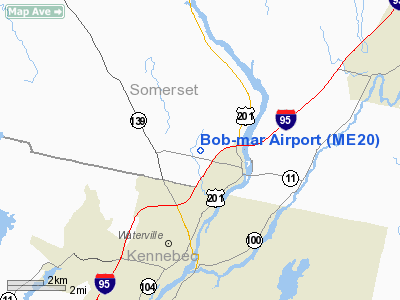
| From nearest city: | 1 nautical miles NW of Fairfield, ME |
| Location: | Somerset County, ME |
| Magnetic Variation: | 18W (1985) |
Owner & Manager
| Ownership: | Privately owned |
| Owner: | Daniel R. Gilbert |
| Address: | 246 Ridge Rd
Fairfield, ME 04937 |
| Phone number: | 207-453-2822 |
| Manager: | Daniel R. Gilbert |
| Address: | 246 Ridge Rd
Fairfield, ME 04937 |
| Phone number: | 207-453-2822 |
Airport Operations and Facilities
| Airport Use: | Private |
| Wind indicator: | Yes |
| Segmented Circle: | No |
| Control Tower: | No |
| Sectional chart: | Montreal |
| Region: | ANE - New England |
| Boundary ARTCC: | ZBW - Boston |
| Tie-in FSS: | BGR - Bangor |
| FSS on Airport: | No |
| FSS Toll Free: | 1-800-WX-BRIEF |
Runway Information
Runway 18/36
| Dimension: | 1400 x 75 ft / 426.7 x 22.9 m |
| Surface: | TURF, |
| |
Runway 18 |
Runway 36 |
| Traffic Pattern: | Left | Left |
| Obstruction: | 50 ft trees, 100.0 ft from runway | |
|
Radio Navigation Aids
| ID |
Type |
Name |
Ch |
Freq |
Var |
Dist |
| RL | NDB | Bracy | | 399.00 | 18W | 9.6 nm |
| BUP | NDB | Burnham | | 348.00 | 18W | 12.8 nm |
| BST | NDB | Belfast | | 278.00 | 18W | 28.6 nm |
| ISS | NDB | Wiscasset | | 407.00 | 18W | 37.1 nm |
| SUH | NDB | Sprucehead | | 356.00 | 18W | 39.8 nm |
| OLD | NDB | Old Town | | 272.00 | 20W | 48.8 nm |
| NHZ | TACAN | Brunswick | 099X | | 17W | 45.5 nm |
| AUG | VOR/DME | Augusta | 051X | 111.40 | 18W | 18.3 nm |
| BGR | VORTAC | Bangor | 095X | 114.80 | 19W | 35.2 nm |
| BGR | VOT | Bangor | | 111.00 | | 36.9 nm |
Remarks
Images and information placed above are from
http://www.airport-data.com/airport/ME20/
We thank them for the data!
| General Info
|
| Country |
United States
|
| State |
MAINE
|
| FAA ID |
ME20
|
| Latitude |
44-35-57.235N
|
| Longitude |
069-37-26.166W
|
| Elevation |
310 feet
|
| Near City |
FAIRFIELD
|
We don't guarantee the information is fresh and accurate. The data may
be wrong or outdated.
For more up-to-date information please refer to other sources.
|
|


