 |
|
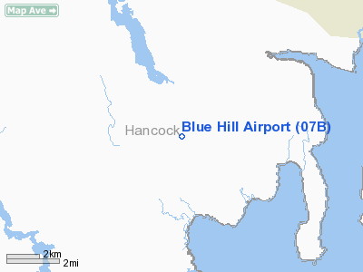
Location & QuickFacts
| FAA Information Effective: | 2008-09-25 |
| Airport Identifier: | 07B |
| Airport Status: | Operational |
| Longitude/Latitude: | 068-34-10.9000W/44-26-52.7000N
-68.569694/44.447972 (Estimated) |
| Elevation: | 360 ft / 109.73 m (Estimated) |
| Land: | 25 acres |
| From nearest city: | 3 nautical miles NE of Blue Hill, ME |
| Location: | Hancock County, ME |
| Magnetic Variation: | 19W (1985) |
Owner & Manager
| Ownership: | Privately owned |
| Owner: | Madcap Properties |
| Address: | 62 Sculpin Lane
Blue Hill, ME 04614 |
| Phone number: | 207-374-5610 |
| Manager: | Jeffery C. Becton |
| Address: | 94 French Camp Road
Deer Isle, ME 04627 |
| Phone number: | 207-348-6108
FOR RUNWAY ACCESS CALL 207-374-5069 - BARNEY LIMEBURNER. |
Airport Operations and Facilities
| Airport Use: | Open to public |
| Wind indicator: | Yes |
| Segmented Circle: | No |
| Control Tower: | No |
| Landing fee charge: | No |
| Sectional chart: | Halifax |
| Region: | ANE - New England |
| Boundary ARTCC: | ZBW - Boston |
| Tie-in FSS: | BGR - Bangor |
| FSS on Airport: | No |
| FSS Toll Free: | 1-800-WX-BRIEF |
| NOTAMs Facility: | BGR (NOTAM-d service avaliable) |
Airport Communications
Airport Services
| Airframe Repair: | NONE |
| Power Plant Repair: | NONE |
Runway Information
Runway 16/34
| Dimension: | 3186 x 100 ft / 971.1 x 30.5 m |
| Surface: | TURF, Fair Condition |
| |
Runway 16 |
Runway 34 |
| Longitude: | 068-34-21.9209W | 068-33-59.8403W |
| Latitude: | 44-27-06.3134N | 44-26-39.1168N |
| Elevation: | 363.00 ft | 322.00 ft |
| Traffic Pattern: | Left | Left |
| Markings: | None, | None, |
| Centerline Lights: | No | No |
| Obstruction: | 55 ft trees, 100 ft left of centerline | 65 ft trees, 0.0 ft from runway, 100 ft left of centerline |
|
Radio Navigation Aids
| ID |
Type |
Name |
Ch |
Freq |
Var |
Dist |
| BH | NDB | Surry | | 330.00 | 19W | 12.5 nm |
| BST | NDB | Belfast | | 278.00 | 18W | 19.1 nm |
| SUH | NDB | Sprucehead | | 356.00 | 18W | 33.2 nm |
| OLD | NDB | Old Town | | 272.00 | 20W | 33.7 nm |
| BUP | NDB | Burnham | | 348.00 | 18W | 36.9 nm |
| MVM | NDB | Machias | | 251.00 | 19W | 49.2 nm |
| RL | NDB | Bracy | | 399.00 | 18W | 50.0 nm |
| BGR | VORTAC | Bangor | 095X | 114.80 | 19W | 27.0 nm |
| BGR | VOT | Bangor | | 111.00 | | 23.8 nm |
Remarks
- RY NOT PLOWED DURG WINTER MONTHS & CLSD WHEN SNOW ON SFC EXCEPT TO SKI ACFT.
- RY 16/34 BORDERED ON BOTH SIDES BY 40 FT TO 70 FT TREES.
- EXISTED PRIOR TO 1959.
Images and information placed above are from
http://www.airport-data.com/airport/07B/
We thank them for the data!
| General Info
|
| Country |
United States
|
| State |
MAINE
|
| FAA ID |
07B
|
| Latitude |
44-26-52.700N
|
| Longitude |
068-34-10.900W
|
| Elevation |
360 feet
|
| Near City |
BLUE HILL
|
We don't guarantee the information is fresh and accurate. The data may
be wrong or outdated.
For more up-to-date information please refer to other sources.
|
|


