 |
|
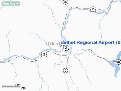
| Bethel Regional Airport |
| IATA: none – ICAO: none – FAA LID: 0B1 |
| Summary |
| Airport type |
Public |
| Owner |
Town of Bethel |
| Location |
Bethel, Maine |
| Elevation AMSL |
654 ft / 199 m |
| Coordinates |
44°25′31″N 070°48′36″W / 44.42528°N 70.81°W / 44.42528; -70.81 |
| Website |
FlyBethelMaine.com |
| Runways |
| Direction |
Length |
Surface |
| ft |
m |
| 14/32 |
3,818 |
1,164 |
Asphalt |
| Statistics (2006) |
| Aircraft operations |
4,520 |
| Based aircraft |
13 |
| Source: Federal Aviation Administration |
Bethel Regional Airport (FAA LID: 0B1) is a public airport located two miles (3 km) northwest of the central business district of Bethel, a town in Oxford County, Maine, United States. It is owned by the Town of Bethel.
The airport is currently not served by any commercial airline, though on-demand service once served the airport from Bedford, MA on Linear Air. A free shuttle runs between the town of Bethel and Sunday River ski resort, stopping at the airport on-demand and for occasional scheduled stops.
Facilities and aircraft
Bethel Regional Airport covers an area of 225 acres (91 ha) which contains one asphalt paved runway (14/32) measuring 3,818 x 75 ft (1,164 x 23 m).
For the 12-month period ending August 26, 2006, the airport had 4,520 aircraft operations, an average of 12 per day: 99.6% general aviation and 0.4% military. There are 13 aircraft based at this airport: 77% single-engine, 15% ultralight and 8% multi-engine.
The above content comes from Wikipedia and is published under free licenses – click here to read more.
Location & QuickFacts
| FAA Information Effective: | 2008-09-25 |
| Airport Identifier: | 0B1 |
| Airport Status: | Operational |
| Longitude/Latitude: | 070-48-35.7000W/44-25-30.6000N
-70.809917/44.425167 (Estimated) |
| Elevation: | 654 ft / 199.34 m (Estimated) |
| Land: | 225 acres |
| From nearest city: | 2 nautical miles NW of Bethel, ME |
| Location: | Oxford County, ME |
| Magnetic Variation: | 17W (1985) |
Owner & Manager
| Ownership: | Publicly owned |
| Owner: | Town Of Bethel |
| Address: | Po Box 1660
Bethel, ME 04217 |
| Phone number: | 207-824-2669 |
| Manager: | Scott G. Cole
DANNY KENNAGH, ASSISTANT MANAGER 207-890-9764 (CELL) OR 207-824-3256. |
| Address: | Town Of Bethel, Po Box 1660
Bethel, ME 04217 |
| Phone number: | 207-824-2669 |
Airport Operations and Facilities
| Airport Use: | Open to public |
| Wind indicator: | Yes
LGTD WINDSOCK AND APRON LGHTS ON CONTINUOUSLY AT NIGHT. |
| Segmented Circle: | Yes |
| Control Tower: | No |
| Lighting Schedule: | RDO-CTL
ACTVT NSTD LIRL RY 14/32 - CTAF 5 CLICKS STAYS ON FOR 15 MINUTES AND FLASHES PRIOR TO SHUT-DOWN. 5 MORE CLICKS ANYTIME WHILE ON RE-SETS 15 MIN CYCLE. |
| Landing fee charge: | No |
| Sectional chart: | Montreal |
| Region: | ANE - New England |
| Boundary ARTCC: | ZBW - Boston |
| Tie-in FSS: | BGR - Bangor |
| FSS on Airport: | No |
| FSS Toll Free: | 1-800-WX-BRIEF |
| NOTAMs Facility: | BGR (NOTAM-d service avaliable) |
| Federal Agreements: | NGY |
Airport Communications
Airport Services
| Fuel available: | 100LL
SELF-SERVE AVBL 24 HRS WITH CHARGE CARD. |
| Airframe Repair: | NONE |
| Power Plant Repair: | NONE |
| Bottled Oxygen: | NONE |
| Bulk Oxygen: | NONE |
Runway Information
Runway 14/32
| Dimension: | 3818 x 75 ft / 1163.7 x 22.9 m |
| Surface: | ASPH, Good Condition |
| Edge Lights: | Non-standard lighting system
LIRL |
| |
Runway 14 |
Runway 32 |
| Longitude: | 070-48-56.9112W | 070-48-14.4742W |
| Latitude: | 44-25-41.6890N | 44-25-19.4088N |
| Elevation: | 674.00 ft | 656.00 ft |
| Traffic Pattern: | Left | Left |
| Markings: | Basic, Fair Condition
MARKINGS FADED. | Basic, Fair Condition
MARKINGS FADED. |
|
Radio Navigation Aids
| ID |
Type |
Name |
Ch |
Freq |
Var |
Dist |
| SZO | FAN MARKER | Grinn | | | 17W | 28.3 nm |
| HIE | FAN MARKER | Witey | | | 17W | 32.6 nm |
| HXK | NDB | Hornebrook | | 281.00 | 17W | 18.3 nm |
| RQM | NDB | Rangeley | | 221.00 | 18W | 30.7 nm |
| SZO | NDB | Sebago | | 227.00 | 17W | 31.3 nm |
| GMA | NDB | Mahn | | 386.00 | 17W | 37.8 nm |
| RL | NDB | Bracy | | 399.00 | 18W | 46.2 nm |
| BML | VOR/DME | Berlin | 041X | 110.40 | 17W | 20.4 nm |
| AUG | VOR/DME | Augusta | 051X | 111.40 | 18W | 44.0 nm |
Remarks
- UNLGTD MOUNTAINOUS TERRAIN SURROUNDING AIRPORT.
- FOR RY CONDITIONS, CTC ASST ARPT MGR 207-890-9764.
- POWERED PARACHUTE ACTIVITY OCASSIONALLY IN TERMINAL AREA.
- EXISTED PRIOR TO 1959.
Images and information placed above are from
http://www.airport-data.com/airport/0B1/
We thank them for the data!
| General Info
|
| Country |
United States
|
| State |
MAINE
|
| FAA ID |
0B1
|
| Latitude |
44-25-30.600N
|
| Longitude |
070-48-35.700W
|
| Elevation |
654 feet
|
| Near City |
BETHEL
|
We don't guarantee the information is fresh and accurate. The data may
be wrong or outdated.
For more up-to-date information please refer to other sources.
|
|


