 |
|
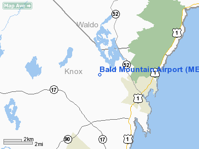
Location & QuickFacts
| FAA Information Effective: | 2008-09-25 |
| Airport Identifier: | ME14 |
| Airport Status: | Operational |
| Longitude/Latitude: | 069-07-23.1400W/44-13-50.2810N
-69.123094/44.230634 (Estimated) |
| Elevation: | 570 ft / 173.74 m (Estimated) |
| Land: | 0 acres |
| From nearest city: | 3 nautical miles NW of Camden, ME |
| Location: | Knox County, ME |
| Magnetic Variation: | 18W (1985) |
Owner & Manager
| Ownership: | Privately owned |
| Owner: | James S. Rockefeller, Jr. |
| Address: | Howe Hill
Camden, ME 04843 |
| Phone number: | 207-236-3915 |
| Manager: | James Rockefeller |
| Address: | Howe Hill
Camden, ME 04843 |
| Phone number: | 207-236-3915 |
Airport Operations and Facilities
| Airport Use: | Private |
| Wind indicator: | Yes |
| Segmented Circle: | No |
| Control Tower: | No |
| Landing fee charge: | No |
| Sectional chart: | Montreal |
| Region: | ANE - New England |
| Boundary ARTCC: | ZBW - Boston |
| Tie-in FSS: | BGR - Bangor |
| FSS on Airport: | No |
| FSS Toll Free: | 1-800-WX-BRIEF |
Airport Services
| Airframe Repair: | NONE |
| Power Plant Repair: | NONE |
Runway Information
Runway 04/22
| Dimension: | 1800 x 150 ft / 548.6 x 45.7 m |
| Surface: | TURF, |
| |
Runway 04 |
Runway 22 |
| Traffic Pattern: | Left | Left |
|
Runway 13/31
| Dimension: | 700 x 150 ft / 213.4 x 45.7 m |
| Surface: | TURF, |
| |
Runway 13 |
Runway 31 |
| Traffic Pattern: | Left | Left |
|
Radio Navigation Aids
| ID |
Type |
Name |
Ch |
Freq |
Var |
Dist |
| SUH | NDB | Sprucehead | | 356.00 | 18W | 10.9 nm |
| BST | NDB | Belfast | | 278.00 | 18W | 11.9 nm |
| ISS | NDB | Wiscasset | | 407.00 | 18W | 26.8 nm |
| RL | NDB | Bracy | | 399.00 | 18W | 29.7 nm |
| BUP | NDB | Burnham | | 348.00 | 18W | 29.8 nm |
| BH | NDB | Surry | | 330.00 | 19W | 39.7 nm |
| NHZ | TACAN | Brunswick | 099X | | 17W | 40.6 nm |
| AUG | VOR/DME | Augusta | 051X | 111.40 | 18W | 29.5 nm |
| BGR | VORTAC | Bangor | 095X | 114.80 | 19W | 38.3 nm |
| BGR | VOT | Bangor | | 111.00 | | 37.0 nm |
Remarks
Images and information placed above are from
http://www.airport-data.com/airport/ME14/
We thank them for the data!
| General Info
|
| Country |
United States
|
| State |
MAINE
|
| FAA ID |
ME14
|
| Latitude |
44-13-50.281N
|
| Longitude |
069-07-23.140W
|
| Elevation |
570 feet
|
| Near City |
CAMDEN
|
We don't guarantee the information is fresh and accurate. The data may
be wrong or outdated.
For more up-to-date information please refer to other sources.
|
|


