 |
|
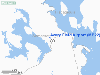
Location & QuickFacts
| FAA Information Effective: | 2008-09-25 |
| Airport Identifier: | ME22 |
| Airport Status: | Operational |
| Longitude/Latitude: | 069-48-24.4000W/45-40-16.2000N
-69.806778/45.671167 (Estimated) |
| Elevation: | 1070 ft / 326.14 m (Estimated) |
| Land: | 0 acres |
| From nearest city: | 2 nautical miles W of Rockwood, ME |
| Location: | Somerset County, ME |
| Magnetic Variation: | () |
Owner & Manager
| Ownership: | Privately owned |
| Owner: | William Avery |
| Address: | 303 Maynards Road
Rockwood, ME 04478 |
| Phone number: | 207-534-7516 |
| Manager: | William Avery |
| Address: | 303 Maynards Road
Rockwood, ME 04478 |
| Phone number: | 207-534-7516 |
Airport Operations and Facilities
| Airport Use: | Private |
| Control Tower: | No |
| Sectional chart: | Montreal |
| Region: | ANE - New England |
| Boundary ARTCC: | ZBW - Boston |
| Tie-in FSS: | BGR - Bangor |
| FSS Toll Free: | 1-800-WX-BRIEF |
Runway Information
Runway 11/29
| Dimension: | 2000 x 100 ft / 609.6 x 30.5 m |
| Surface: | TURF, |
| |
Runway 11 |
Runway 29 |
| Traffic Pattern: | Left | Left |
| Obstruction: | 50 ft trees, 100.0 ft from runway | 50 ft trees, 100.0 ft from runway |
|
Radio Navigation Aids
| ID |
Type |
Name |
Ch |
Freq |
Var |
Dist |
| XQA | NDB | Squaw | | 236.00 | 18W | 10.6 nm |
| VLV | VOR/DME | Beauce | 119X | 117.20 | 18W | 46.1 nm |
Remarks
- PRVDD PR USE, VFR OPNS, & SATISFACTORY FOR SMALL LAND PLANES.
Images and information placed above are from
http://www.airport-data.com/airport/ME22/
We thank them for the data!
We don't guarantee the information is fresh and accurate. The data may
be wrong or outdated.
For more up-to-date information please refer to other sources.
|
|


