 |
|
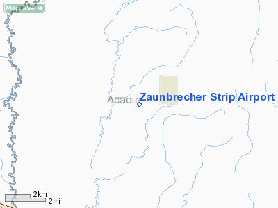
Zaunbrecher Strip Airport |
|
Location &
QuickFacts
|
FAA
Information Effective: |
2008-09-25 |
|
Airport
Identifier: |
LA68 |
|
Airport
Status: |
Operational |
|
Longitude/Latitude: |
092-31-11.4900W/30-18-56.7330N
-92.519858/30.315759 (Estimated) |
|
Elevation: |
26 ft / 7.92 m (Estimated) |
|
Land: |
5 acres |
|
From
nearest city: |
2 nautical miles W of Iota, LA |
|
Location: |
Acadia Parish, LA |
|
Magnetic Variation: |
04E (1990) |
Owner & Manager
|
Ownership: |
Privately owned |
|
Owner: |
Leonard (doc) Zaunbrecher |
|
Address: |
1180 Mccain Rd
Crowley, LA 70526 |
|
Phone number: |
318-783-0973 |
|
Manager: |
Leonard Zaunbrecher |
|
Address: |
Rr 3 Box 235
Crowley, LA 70526 |
|
Phone number: |
318-783-0973 |
Airport
Operations and Facilities
|
Airport
Use: |
Private |
|
Wind
indicator: |
Yes |
|
Segmented Circle: |
No |
|
Control
Tower: |
No |
|
Sectional chart: |
Houston |
|
Region: |
ASW - Southwest |
|
Boundary
ARTCC: |
ZHU - Houston |
|
Tie-in
FSS: |
DRI - De Ridder |
|
FSS on
Airport: |
No |
|
FSS Toll
Free: |
1-800-WX-BRIEF |
|
Runway Information
Runway 08/26
|
Dimension: |
2350 x 60 ft / 716.3 x 18.3 m |
|
Surface: |
TURF, |
|
|
Runway 08
|
Runway 26
|
|
Traffic
Pattern: |
Left |
Left |
|
Obstruction: |
|
40 ft plines, 150.0 ft from runway |
|
Radio Navigation Aids
|
ID |
Type |
Name |
Ch |
Freq |
Var |
Dist |
|
ECY |
NDB |
Eunice |
|
263.00 |
02E |
15.1 nm |
|
LRR |
NDB |
Allen Parish |
|
379.00 |
03E |
21.4 nm |
|
OPL |
NDB |
St Landry |
|
335.00 |
04E |
29.9 nm |
|
BWK |
NDB |
Bunkie |
|
397.00 |
03E |
36.2 nm |
|
AR |
NDB |
Acadi |
|
269.00 |
03E |
40.4 nm |
|
UX |
NDB |
Sulfy |
|
278.00 |
04E |
47.3 nm |
|
DQU |
NDB |
De Quincy |
|
410.00 |
05E |
49.6 nm |
|
DR |
NDB |
Idder |
|
385.00 |
04E |
49.7 nm |
|
LLA |
VOR/DME |
White Lake |
041X |
110.40 |
04E |
40.0 nm |
|
LFT |
VORTAC |
Lafayette |
035X |
109.80 |
03E |
28.3 nm |
|
LCH |
VORTAC |
Lake Charles |
081X |
113.40 |
07E |
32.2 nm |
Remarks
-
HVY AGRICULTURAL
OPNS DURING MAR-JUL.
Zaunbrecher Strip Airport
Address:
Acadia Parish, LA
Tel:
318-783-0973
Images
and information placed above are from
http://www.airport-data.com/airport/LA68/
We
thank them for the data!
|
General Info |
| Country |
United
States |
| State |
LOUISIANA |
| FAA ID |
LA68
|
| Latitude |
30-18-56.733N |
|
Longitude |
092-31-11.490W |
|
Elevation |
26 feet
|
| Near
City |
IOTA
|
We don't guarantee the information is fresh and accurate. The data may
be wrong or outdated.
For more up-to-date information please refer to other sources.
|
|


