 |
|
|
|
|
|
|
Location &
QuickFacts
|
FAA
Information Effective: |
2008-09-25 |
|
Airport
Identifier: |
1R4 |
|
Airport
Status: |
Operational |
|
Longitude/Latitude: |
092-30-04.6400W/31-07-34.8700N
-92.501289/31.126353 (Estimated) |
|
Elevation: |
140 ft / 42.67 m (Estimated) |
|
Land: |
10 acres |
|
From
nearest city: |
2 nautical miles S of Woodworth, LA |
|
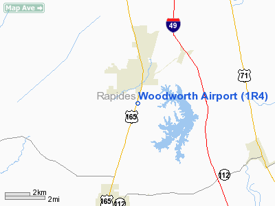
Location: |
Rapides Parish, LA |
|
Magnetic Variation: |
04E (1985) |
Owner & Manager
|
Ownership: |
Publicly owned |
|
Owner: |
La Dept Of Agriculture's
FORESTRY. |
|
Address: |
Po Box 298
Woodworth, LA 71485 |
|
Phone number: |
318-487-5989 |
|
Manager: |
David Branch |
|
Address: |
Po Box 298
Woodworth, LA 71485 |
|
Phone number: |
318-487-5989 |
Airport
Operations and Facilities
|
Airport
Use: |
Open to public |
|
Wind
indicator: |
Yes |
|
Segmented Circle: |
No |
|
Control
Tower: |
No |
|
Lighting
Schedule: |
DUSK-DAWN
ACTVT MIRL RY 01/19 - 122.8. |
|
Beacon
Color: |
Clear-Green (lighted land airport) |
|
Landing
fee charge: |
No |
|
Sectional chart: |
Houston |
|
Region: |
ASW - Southwest |
|
Boundary
ARTCC: |
ZHU - Houston |
|
Tie-in
FSS: |
DRI - De Ridder |
|
FSS on
Airport: |
No |
|
FSS Toll
Free: |
1-800-WX-BRIEF |
|
NOTAMs
Facility: |
DRI (NOTAM-d service avaliable) |
Airport Communications
|
Runway Information
Runway 01/19
|
Dimension: |
3100 x 75 ft / 944.9 x 22.9 m |
|
Surface: |
ASPH, Good Condition |
|
Weight Limit: |
Single wheel: 12000 lbs. |
|
Edge Lights: |
Medium |
|
|
Runway 01
|
Runway 19
|
|
Longitude: |
092-30-09.9300W |
092-29-59.3500W |
|
Latitude: |
31-07-20.2200N |
31-07-49.5200N |
|
Traffic
Pattern: |
Left |
Left |
|
Markings: |
Basic, Good Condition |
Basic, Good Condition |
|
Crossing
Height: |
20.00 ft |
20.00 ft |
|
VASI: |
2-box SAVASI on right side
SAVASI OTS INDEFLY.. |
2-box SAVASI on right side |
|
Visual
Glide Angle: |
4.00° |
4.00° |
|
Obstruction: |
30 ft trees, 650.0 ft from runway, 15:1 slope to clear |
60 ft trees, 1800.0 ft from runway, 26:1 slope to clear |
|
Radio Navigation Aids
|
ID |
Type |
Name |
Ch |
Freq |
Var |
Dist |
|
POE |
FAN MARKER |
South |
|
|
07E |
35.2 nm |
|
POE1 |
FAN MARKER |
North |
|
|
07E |
37.0 nm |
|
BWK |
NDB |
Bunkie |
|
397.00 |
03E |
20.9 nm |
|
MKV |
NDB |
Marksville |
|
347.00 |
02E |
22.1 nm |
|
LRR |
NDB |
Allen Parish |
|
379.00 |
03E |
30.7 nm |
|
ECY |
NDB |
Eunice |
|
263.00 |
02E |
34.2 nm |
|
OPL |
NDB |
St Landry |
|
335.00 |
04E |
35.1 nm |
|
GUV |
NDB |
Gator |
|
359.00 |
05E |
35.7 nm |
|
VED |
NDB |
Leesville |
|
247.00 |
04E |
43.3 nm |
|
IE |
NDB |
Campi |
|
407.00 |
04E |
43.5 nm |
|
DR |
NDB |
Idder |
|
385.00 |
04E |
48.5 nm |
|
AEX |
VORTAC |
Alexandria |
108X |
116.10 |
03E |
7.8 nm |
|
FXU |
VORTAC |
Polk |
021X |
108.40 |
05E |
36.9 nm |
Remarks
Based Aircraft
|
Aircraft based
on field: |
10 |
|
Single Engine
Airplanes: |
9 |
|
Helicopters: |
1 |
Operational Statistics
Time Period: 2006-09-20 - 2007-09-19
|
Aircraft
Operations: |
50/Day |
|
General
Aviation Local: |
55.6% |
|
General
Aviation Itinerant: |
44.4% |
Woodworth Airport
Address:
Rapides Parish, LA
Tel:
318-487-5989
Images
and information placed above are from
http://www.airport-data.com/airport/1R4/
We
thank them for the data!
|
General Info |
| Country |
United
States |
| State |
LOUISIANA |
| FAA ID |
1R4
|
| Latitude |
31-07-35.000N |
|
Longitude |
092-30-05.000W |
|
Elevation |
140 feet
|
| Near
City |
WOODWORTH |
We don't guarantee the information is fresh and accurate. The data may
be wrong or outdated.
For more up-to-date information please refer to other sources.
|
|


