 |
|
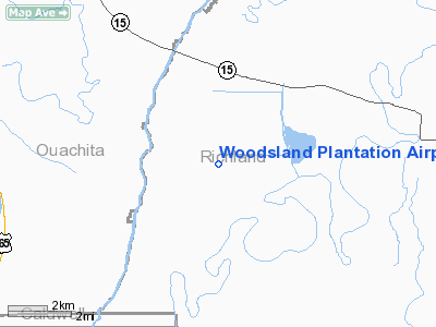
Woodsland Plantation Airport |
|
Location &
QuickFacts
|
FAA
Information Effective: |
2008-09-25 |
|
Airport
Identifier: |
40LA |
|
Airport
Status: |
Operational |
|
Longitude/Latitude: |
091-58-10.4730W/32-20-45.5320N
-91.969576/32.345981 (Estimated) |
|
Elevation: |
60 ft / 18.29 m (Estimated) |
|
Land: |
0 acres |
|
From
nearest city: |
10 nautical miles SE of Monroe, LA |
|
Location: |
Richland Parish, LA |
|
Magnetic Variation: |
04E (1985) |
Owner & Manager
|
Ownership: |
Privately owned |
|
Owner: |
W. Elton Kennedy |
|
Address: |
Po Box 259
Mer Rouge, LA 71261 |
|
Phone
number: |
318-647-5744 |
|
Manager: |
W. Elton Kennedy |
|
Address: |
Po Box 259
Mer Rouge, LA 71261 |
|
Phone number: |
318-647-5744 |
Airport Operations and Facilities
|
Airport
Use: |
Private |
|
Wind
indicator: |
Yes |
|
Segmented Circle: |
No |
|
Control
Tower: |
No |
|
Landing
fee charge: |
No |
|
Sectional chart: |
Memphis |
|
Region: |
ASW - Southwest |
|
Boundary
ARTCC: |
ZFW - Fort Worth |
|
Tie-in
FSS: |
DRI - De Ridder |
|
FSS on
Airport: |
No |
|
FSS Toll
Free: |
1-800-WX-BRIEF |
|
Runway Information
Runway 18/36
|
Dimension: |
4800 x 130 ft / 1463.0 x 39.6 m |
|
Surface: |
TURF, |
|
|
Runway 18
|
Runway 36
|
|
Traffic
Pattern: |
Right |
Right |
|
Radio Navigation Aids
|
ID |
Type |
Name |
Ch |
Freq |
Var |
Dist |
|
MRK |
NDB |
Molly Ridge |
|
338.00 |
02E |
10.6 nm |
|
BQP |
NDB |
Bastrop |
|
329.00 |
03E |
25.0 nm |
|
TUF |
NDB |
Stuckey |
|
350.00 |
03E |
31.7 nm |
|
ROQ |
NDB |
Ruston |
|
368.00 |
03E |
35.1 nm |
|
JBL |
NDB |
Hodge |
|
256.00 |
04E |
39.4 nm |
|
IFJ |
NDB |
Winnfield |
|
402.00 |
04E |
41.9 nm |
|
TV |
NDB |
Savry |
|
344.00 |
02E |
48.3 nm |
|
BLE |
NDB |
Lake Providence |
|
278.00 |
03E |
49.1 nm |
|
SWB |
VOR/DME |
Sawmill |
84Y |
113.75 |
02E |
42.4 nm |
|
MLU |
VORTAC |
Monroe |
119X |
117.20 |
03E |
10.8 nm |
Remarks
-
PRVDD A MIN 20:1
APCH SLOPE TO EACH END OF RWY IS MAINTD.
Woodsland Plantation Airport
Address:
Richland Parish, LA
Tel:
318-647-5744
Images
and information placed above are from
http://www.airport-data.com/airport/40LA/
We
thank them for the data!
|
General Info |
| Country |
United
States |
| State |
LOUISIANA |
| FAA ID |
40LA
|
| Latitude |
32-20-45.532N |
|
Longitude |
091-58-10.473W |
|
Elevation |
60 feet
|
| Near
City |
MONROE
|
We don't guarantee the information is fresh and accurate. The data may
be wrong or outdated.
For more up-to-date information please refer to other sources.
|
|


