 |
|
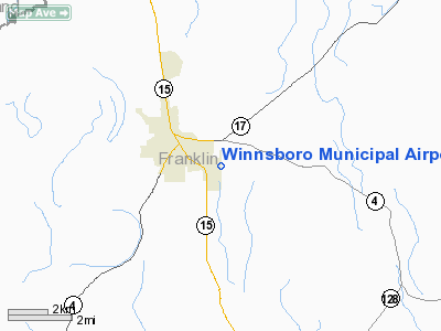
Winnsboro Municipal Airport |
|
|
|
Location &
QuickFacts
|
FAA
Information Effective: |
2008-09-25 |
|
Airport
Identifier: |
F89 |
|
Airport
Status: |
Operational |
|
Longitude/Latitude: |
091-41-54.8050W/32-09-10.8250N
-91.698557/32.153007 (Estimated) |
|
Elevation: |
76 ft / 23.16 m (Surveyed) |
|
Land: |
90 acres |
|
From
nearest city: |
1 nautical miles E of Winnsboro, LA |
|
Location: |
Franklin Parish, LA |
|
Magnetic Variation: |
04E (1985) |
Owner & Manager
|
Ownership: |
Publicly owned |
|
Owner: |
City Of Winnsboro |
|
Address: |
Po Box 250
Winnsboro, LA 71295 |
|
Phone number: |
318-435-9087 |
|
Manager: |
Pete Wollerson |
|
Address: |
Po Box 278
Winnsboro, LA 71295 |
|
Phone number: |
318-435-5400 |
Airport
Operations and Facilities
|
Airport
Use: |
Open to public |
|
Wind
indicator: |
Yes |
|
Segmented Circle: |
No |
|
Control
Tower: |
No |
|
Lighting
Schedule: |
DUSK-DAWN
ACTVT MIRL RY 18/36 AND REIL RY 36 - CTAF |
|
Beacon
Color: |
Clear-Green (lighted land airport)
ROTG BCN OTS INDEFLY. |
|
Landing
fee charge: |
No |
|
Sectional chart: |
Memphis |
|
Region: |
ASW - Southwest |
|
Boundary
ARTCC: |
ZHU - Houston |
|
Responsible ARTCC: |
ZFW - Fort Worth |
|
Tie-in
FSS: |
DRI - De Ridder |
|
FSS on
Airport: |
No |
|
FSS Toll
Free: |
1-800-WX-BRIEF |
|
NOTAMs
Facility: |
DRI (NOTAM-d service avaliable) |
|
Federal Agreements: |
N |
Airport Communications
|
CTAF: |
122.800 |
|
Unicom: |
122.800 |
Airport Services
|
Fuel
available: |
100LL
FUEL AVBL 24 HRS SELF SERVE WITH CREDIT CARD. |
|
Airframe
Repair: |
MINOR |
|
Power
Plant Repair: |
MINOR |
|
Bottled
Oxygen: |
NONE |
|
Bulk
Oxygen: |
NONE |
|
Runway Information
Runway 18/36
|
Dimension: |
3000 x 75 ft / 914.4 x 22.9 m |
|
Surface: |
ASPH, Good Condition |
|
Weight Limit: |
Single wheel: 11000 lbs. |
|
Edge Lights: |
Medium |
|
|
Runway 18
|
Runway 36
|
|
Longitude: |
091-41-54.6500W |
091-41-54.9600W |
|
Latitude: |
32-09-25.6700N |
32-08-55.9800N |
|
Traffic
Pattern: |
Left |
Left |
|
Markings: |
Basic, Fair Condition
RY 18/36 MARKINGS CRACKED & FADED. |
Basic, Fair Condition |
|
Crossing
Height: |
20.00 ft |
20.00 ft |
|
VASI: |
2-box SAVASI on left side |
2-box SAVASI on left side |
|
Visual
Glide Angle: |
4.00° |
4.00° |
|
Runway End
Identifier: |
|
Yes
REIL OTS INDEFLY. |
|
Obstruction: |
60 ft trees, 1200.0 ft from runway, 250 ft left of
centerline, 16:1 slope to clear |
, 50:1 slope to clear |
|
Radio Navigation Aids
|
ID |
Type |
Name |
Ch |
Freq |
Var |
Dist |
|
MRK |
NDB |
Molly Ridge |
|
338.00 |
02E |
15.7 nm |
|
HAH |
NDB |
Natchez-adams County |
|
388.00 |
03E |
34.7 nm |
|
TV |
NDB |
Savry |
|
344.00 |
02E |
34.7 nm |
|
BQP |
NDB |
Bastrop |
|
329.00 |
03E |
37.4 nm |
|
VKS |
NDB |
Vicksburg |
|
382.00 |
03E |
39.6 nm |
|
TUF |
NDB |
Stuckey |
|
350.00 |
03E |
47.8 nm |
|
BLE |
NDB |
Lake Providence |
|
278.00 |
03E |
48.2 nm |
|
HEZ |
VOR/DME |
Natchez |
037X |
110.00 |
03E |
38.1 nm |
|
MLU |
VORTAC |
Monroe |
119X |
117.20 |
03E |
27.8 nm |
Remarks
-
< THRU JUNE OPS ACFT AGRI>
-
RY 18/36 TREES
WEST OF RY OBSTRUCT VIEW OF OPERATING ACFT.
-
RY 18/36 TREES ON
BOTH SIDES OF RY PENETRATE TRANSITION SLOPE.
-
PRE DATES THE ACT.
Based Aircraft
|
Aircraft based
on field: |
18 |
|
Single Engine
Airplanes: |
14 |
|
Helicopters: |
1 |
|
Ultralights: |
3 |
Operational Statistics
Time Period: 2006-08-30 - 2007-08-29
|
Aircraft
Operations: |
55/Day |
|
General
Aviation Local: |
75.0% |
|
General
Aviation Itinerant: |
25.0% |
Winnsboro Municipal Airport
Address:
Franklin Parish, LA
Tel:
318-435-9087, 318-435-5400
Images
and information placed above are from
http://www.airport-data.com/airport/F89/
We
thank them for the data!
|
General Info |
| Country |
United
States |
| State |
LOUISIANA |
| FAA ID |
F89
|
| Latitude |
32-09-10.650N |
|
Longitude |
091-41-54.440W |
|
Elevation |
76 feet
|
| Near
City |
WINNSBORO |
We don't guarantee the information is fresh and accurate. The data may
be wrong or outdated.
For more up-to-date information please refer to other sources.
|
|


