 |
|
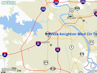
Willis-knighton Medical Center Temp Groundlevel Heliport |
|
|
|
Location &
QuickFacts
|
FAA
Information Effective: |
2008-09-25 |
|
Airport
Identifier: |
LS78 |
|
Airport
Status: |
Operational |
|
Longitude/Latitude: |
093-46-40.6460W/32-29-10.5500N
-93.777957/32.486264 (Estimated) |
|
Elevation: |
253 ft / 77.11 m (Estimated) |
|
Land: |
0 acres |
|
From
nearest city: |
0 nautical miles N of Shreveport, LA |
|
Location: |
Caddo Parish, LA |
|
Magnetic Variation: |
05E (1985) |
Owner & Manager
|
Ownership: |
Privately owned |
|
Owner: |
Willis-knighton Med. Center |
|
Address: |
2600 Greenwood Road
Shreveport, LA 71103 |
|
Phone number: |
318-212-4705 |
|
Manager: |
Jerry Ivey |
|
Address: |
2600 Greenwood Road
Shreveport, LA 71103 |
|
Phone number: |
318-212-8529 |
Airport
Operations and Facilities
|
Airport
Use: |
Private
MEDICAL. |
|
Wind
indicator: |
Yes |
|
Segmented Circle: |
No |
|
Control
Tower: |
No |
|
Lighting
Schedule: |
PHONE REQ
FOR PERIMETER LGTS CALL 318-632-4705. |
|
Sectional chart: |
Memphis |
|
Region: |
ASW - Southwest |
|
Boundary ARTCC: |
ZFW - Fort Worth |
|
Tie-in FSS: |
DRI - De Ridder |
|
FSS on Airport: |
No |
|
FSS Toll Free: |
1-800-WX-BRIEF |
Airport
Communications
|
Runway Information
Helipad H1
|
Dimension: |
70 x 70 ft / 21.3 x 21.3 m |
|
Surface: |
CONC, |
|
|
Runway H1
|
Runway
|
|
Traffic
Pattern: |
Left |
Left |
|
Radio Navigation Aids
|
ID |
Type |
Name |
Ch |
Freq |
Var |
Dist |
|
VIV |
NDB |
Vivian |
|
284.00 |
06E |
25.3 nm |
|
MSD |
NDB |
Mansfield |
|
414.00 |
04E |
25.4 nm |
|
MNE |
NDB |
Minden |
|
201.00 |
04E |
25.8 nm |
|
SPH |
NDB |
Springhill |
|
375.00 |
05E |
32.1 nm |
|
RPF |
NDB |
Carthage |
|
332.00 |
04E |
32.1 nm |
|
ATA |
NDB |
Atlanta |
|
347.00 |
04E |
42.6 nm |
|
HMQ |
NDB |
Homer |
|
212.00 |
02E |
43.4 nm |
|
CZJ |
NDB |
Amason |
|
341.00 |
04E |
43.7 nm |
|
BAD |
TACAN |
Barksdale |
105X |
|
05E |
5.7 nm |
|
DTN |
VOR |
Downtown |
|
108.60 |
07E |
3.7 nm |
|
EMG |
VORTAC |
Elm Grove |
049X |
111.20 |
07E |
10.6 nm |
|
EIC |
VORTAC |
Belcher |
121X |
117.40 |
07E |
17.2 nm |
|
GGG |
VORTAC |
Gregg County |
070X |
112.30 |
07E |
49.6 nm |
|
SHV |
VOT |
Shreveport Regional |
|
108.20 |
|
8.2 nm |
Remarks
-
PRVDD VFR; A LGTD
WIND INDICATOR IS MAINTAINED; A SAFETY BARRIER IS PLACED AROUND HELIPORT; A
SIGN IS INSTALLED WARNING PERSON OF OPERATION AREA; INGRESS/EGRESS TO/FM SW;
AND THE MEDICAL CTR ENTERS INTO AN OPERATIONAL LTR OF AGREEMENT WITH
SHREVEPORT REGIONAL ATCT.
Based Aircraft
|
Aircraft based
on field: |
1 |
|
Helicopters: |
1 |
Willis-knighton Medical Center Temp
Groundlevel Heliport
Address:
Caddo Parish, LA
Tel:
318-212-4705, 318-212-8529
Images
and information placed above are from
http://www.airport-data.com/airport/LS78/
We
thank them for the data!
|
General Info |
| Country |
United
States |
| State |
LOUISIANA |
| FAA ID |
LS78
|
| Latitude |
32-29-10.550N |
|
Longitude |
093-46-40.646W |
|
Elevation |
253 feet
|
| Near
City |
SHREVEPORT |
We don't guarantee the information is fresh and accurate. The data may
be wrong or outdated.
For more up-to-date information please refer to other sources.
|
|


