 |
|
|
Location &
QuickFacts
|
FAA
Information Effective: |
2008-09-25 |
|
Airport
Identifier: |
38LA |
|
Airport
Status: |
Operational |
|
Longitude/Latitude: |
092-10-56.4440W/30-47-03.7030N
-92.182346/30.784362 (Estimated) |
|
Elevation: |
43 ft / 13.11 m (Estimated) |
|
Land: |
0 acres |
|
From
nearest city: |
8 nautical miles NE of Ville Platte, LA |
|
Location: |
St Landry Parish, LA |
|
Magnetic Variation: |
04E (1985) |
Owner & Manager
|
Ownership: |
Privately owned |
|
Owner: |
Bunkie Flying Service, Inc |
|
Address: |
P.o. Box 653
Bunkie, LA 71322 |
|
Phone number: |
318-346-4540 |
|
Manager: |
William M Gallman |
|
Address: |
2029 Hwy 115 W
Bunkie, LA 71322 |
|
Phone number: |
318-346-4540 |
Airport
Operations and Facilities
|
Airport
Use: |
Private |
|
Segmented Circle: |
No |
|
Control
Tower: |
No |
|
Sectional chart: |
Houston |
|
Region: |
ASW - Southwest |
|
Boundary
ARTCC: |
ZHU - Houston |
|
Tie-in
FSS: |
DRI - De Ridder |
|
FSS Toll
Free: |
1-800-WX-BRIEF |
|
Runway Information
Runway 05/23
|
Dimension: |
3000 x 100 ft / 914.4 x 30.5 m |
|
Surface: |
TURF, |
|
|
Runway 05
|
Runway 23
|
|
Traffic
Pattern: |
Left |
Left |
|
Obstruction: |
|
100 ft tower, 150.0 ft from runway |
|
Radio Navigation Aids
|
ID |
Type |
Name |
Ch |
Freq |
Var |
Dist |
|
BWK |
NDB |
Bunkie |
|
397.00 |
03E |
5.6 nm |
|
OPL |
NDB |
St Landry |
|
335.00 |
04E |
8.9 nm |
|
ECY |
NDB |
Eunice |
|
263.00 |
02E |
19.3 nm |
|
MKV |
NDB |
Marksville |
|
347.00 |
02E |
19.5 nm |
|
LRR |
NDB |
Allen Parish |
|
379.00 |
03E |
27.6 nm |
|
HZ |
NDB |
Hazer |
|
356.00 |
04E |
36.9 nm |
|
AEX |
VORTAC |
Alexandria |
108X |
116.10 |
03E |
32.8 nm |
|
LFT |
VORTAC |
Lafayette |
035X |
109.80 |
03E |
36.8 nm |
|
BTR |
VORTAC |
Baton Rouge |
112X |
116.50 |
06E |
49.3 nm |
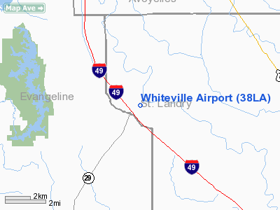
Whiteville Airport
Address:
St Landry Parish, LA
Tel:
318-346-4540
Images
and information placed above are from
http://www.airport-data.com/airport/38LA/
We
thank them for the data!
|
General Info |
| Country |
United
States |
| State |
LOUISIANA |
| FAA ID |
38LA
|
| Latitude |
30-47-03.703N |
|
Longitude |
092-10-56.444W |
|
Elevation |
43 feet
|
| Near
City |
VILLE
PLATTE |
We don't guarantee the information is fresh and accurate. The data may
be wrong or outdated.
For more up-to-date information please refer to other sources.
|
|


