 |
|
|
Location &
QuickFacts
|
FAA
Information Effective: |
2008-09-25 |
|
Airport
Identifier: |
0LA0 |
|
Airport
Status: |
Operational |
|
Longitude/Latitude: |
093-24-00.5620W/30-00-30.7650N
-93.400156/30.008546 (Estimated) |
|
Elevation: |
10 ft / 3.05 m (Estimated) |
|
Land: |
6 acres |
|
From
nearest city: |
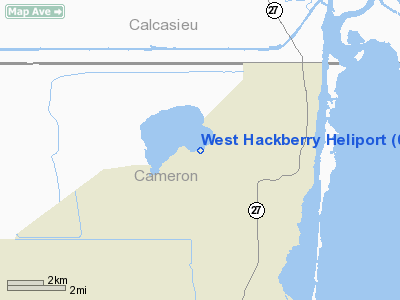
2 nautical miles W of Hackberry, LA |
|
Location: |
Cameron Parish, LA |
|
Magnetic Variation: |
05E (1985) |
Owner & Manager
|
Ownership: |
Publicly owned |
|
Owner: |
Doe Ssr |
|
Address: |
1450 Black Lake Road
Hackberry, LA 70645 |
|
Phone
number: |
337-528-3200 |
|
Manager: |
Ronald A Franqoeur
POINT OF CONATCT: WILLIAM JOHNSON 850 S. CLEARVIEW KWY; NEW ORLEANS,
LA 504-734-4878 |
|
Address: |
1450 Black Lake Road
Hackberry, LA 70645 |
|
Phone number: |
337-528-3201 |
Airport Operations and Facilities
|
Airport
Use: |
Private |
|
Wind
indicator: |
Yes |
|
Segmented Circle: |
No |
|
Control
Tower: |
No |
|
Sectional chart: |
Houston |
|
Region: |
ASW - Southwest |
|
Boundary
ARTCC: |
ZHU - Houston |
|
Tie-in
FSS: |
DRI - De Ridder |
|
FSS Toll
Free: |
1-800-WX-BRIEF |
|
Runway Information
Helipad H1
|
Dimension: |
25 x 25 ft / 7.6 x 7.6 m |
|
Surface: |
CONC, |
|
|
Runway H1
|
Runway
|
|
Traffic
Pattern: |
Left |
Left |
|
Radio Navigation Aids
|
ID |
Type |
Name |
Ch |
Freq |
Var |
Dist |
|
UX |
NDB |
Sulfy |
|
278.00 |
04E |
11.5 nm |
|
ORG |
NDB |
Orange |
|
211.00 |
05E |
20.9 nm |
|
DQU |
NDB |
De Quincy |
|
410.00 |
05E |
25.9 nm |
|
GDE |
NDB |
Goodhue |
|
368.00 |
07E |
41.9 nm |
|
DR |
NDB |
Idder |
|
385.00 |
04E |
44.8 nm |
|
HRD |
NDB |
Hardin County |
|
524.00 |
04E |
48.9 nm |
|
BPT |
VOR/DME |
Beaumont |
092X |
114.50 |
07E |
32.3 nm |
|
SBI |
VOR/DME |
Sabine Pass |
101X |
115.40 |
07E |
38.5 nm |
|
LCH |
VORTAC |
Lake Charles |
081X |
113.40 |
07E |
17.3 nm |
Remarks
-
NORMAL APCH OF
HELICOPTERS IS 310 DEGREES - 120 DEGREES.
West Hackberry Heliport
Address:
Cameron Parish, LA
Tel:
337-528-3200,
337-528-3201
Images
and information placed above are from
http://www.airport-data.com/airport/0LA0/
We
thank them for the data!
|
General Info |
| Country |
United
States |
| State |
LOUISIANA |
| FAA ID |
0LA0
|
| Latitude |
30-00-30.765N |
|
Longitude |
093-24-00.562W |
|
Elevation |
10 feet
|
| Near
City |
HACKBERRY |
We don't guarantee the information is fresh and accurate. The data may
be wrong or outdated.
For more up-to-date information please refer to other sources.
|
|


