 |
|
|
|
|
|
|
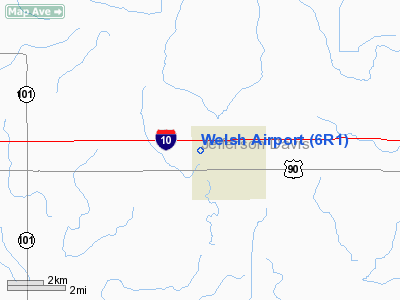
Location &
QuickFacts
|
FAA
Information Effective: |
2008-09-25 |
|
Airport
Identifier: |
6R1 |
|
Airport
Status: |
Operational |
|
Longitude/Latitude: |
092-49-45.5230W/30-14-30.7450N
-92.829312/30.241874 (Estimated) |
|
Elevation: |
18 ft / 5.49 m (Surveyed) |
|
Land: |
179 acres |
|
From
nearest city: |
0 nautical miles NW of Welsh, LA |
|
Location: |
Jefferson Davis Parish, LA |
|
Magnetic Variation: |
07E (1965) |
Owner & Manager
|
Ownership: |
Publicly owned |
|
Owner: |
City Of Welsh |
|
Address: |
P. O. Box 786
Welsh, LA 70591 |
|
Phone
number: |
318-734-2231 |
|
Manager: |
Emery F Lyons |
|
Address: |
City Of Welsh, Po Box 786
Welsh, LA 70591 |
|
Phone number: |
318-734-2594 |
Airport Operations and Facilities
|
Airport
Use: |
Open to public |
|
Wind
indicator: |
Yes |
|
Segmented Circle: |
No |
|
Control
Tower: |
No |
|
Lighting
Schedule: |
DUSK-DAWN |
|
Beacon
Color: |
Clear-Green (lighted land airport) |
|
Landing
fee charge: |
No |
|
Sectional chart: |
Houston |
|
Region: |
ASW - Southwest |
|
Boundary
ARTCC: |
ZHU - Houston |
|
Tie-in
FSS: |
DRI - De Ridder |
|
FSS on
Airport: |
No |
|
FSS Toll
Free: |
1-800-WX-BRIEF |
|
NOTAMs
Facility: |
DRI (NOTAM-d service avaliable) |
|
Federal Agreements: |
1 |
Airport Communications
|
CTAF: |
122.800 |
|
Unicom: |
122.800 |
Airport Services
|
Fuel
available: |
100LL
JET A FUEL AVBL ON EMERG REQ ONLY CALL 318-734-2382. |
|
Airframe
Repair: |
MAJOR |
|
Power
Plant Repair: |
MAJOR |
|
Bottled
Oxygen: |
NONE |
|
Bulk
Oxygen: |
NONE |
|
Runway Information
Runway 07/25
|
Dimension: |
2700 x 50 ft / 823.0 x 15.2 m |
|
Surface: |
ASPH, Good Condition |
|
Weight Limit: |
Single wheel: 6000 lbs. |
|
Edge Lights: |
Medium |
|
|
Runway 07
|
Runway 25
|
|
Longitude: |
092-50-08.2690W |
092-49-39.0790W |
|
Latitude: |
30-14-28.7850N |
30-14-37.1870N |
|
Elevation: |
18.00 ft |
18.00 ft |
|
Alignment: |
72 |
127 |
|
Traffic
Pattern: |
Left |
Left |
|
Markings: |
Non-precision instrument, Good Condition |
Non-precision instrument, Good Condition |
|
Crossing
Height: |
0.00 ft |
23.00 ft |
|
VASI: |
|
2-box SAVASI on left side |
|
Visual
Glide Angle: |
0.00° |
4.00° |
|
Obstruction: |
50 ft trees, 300.0 ft from runway, 250 ft right of
centerline, 2:1 slope to clear
10-50 FT TREES EXTENDING 0-200 FT FM END OF RY & 150-250 FT L/R OF
CNTRLN. |
40 ft trees, 750.0 ft from runway, 220 ft left of
centerline, 13:1 slope to clear |
|
Runway 09/27
|
Dimension: |
2200 x 150 ft / 670.6 x 45.7 m |
|
Surface: |
TURF, Good Condition |
|
|
Runway 09
|
Runway 27
|
|
Longitude: |
092-49-59.5230W |
092-49-34.5230W |
|
Latitude: |
30-14-27.7440N |
30-14-28.7440N |
|
Elevation: |
18.00 ft |
18.00 ft |
|
Alignment: |
87 |
127 |
|
Traffic
Pattern: |
Left |
Left |
|
Obstruction: |
50 ft trees, 650.0 ft from runway, 125 ft right of
centerline, 13:1 slope to clear |
50 ft trees, 500.0 ft from runway, 10:1 slope to clear |
|
Radio Navigation Aids
|
ID |
Type |
Name |
Ch |
Freq |
Var |
Dist |
|
POE |
FAN MARKER |
South |
|
|
07E |
47.5 nm |
|
LRR |
NDB |
Allen Parish |
|
379.00 |
03E |
25.1 nm |
|
ECY |
NDB |
Eunice |
|
263.00 |
02E |
27.5 nm |
|
UX |
NDB |
Sulfy |
|
278.00 |
04E |
30.8 nm |
|
DQU |
NDB |
De Quincy |
|
410.00 |
05E |
35.1 nm |
|
DR |
NDB |
Idder |
|
385.00 |
04E |
40.3 nm |
|
OPL |
NDB |
St Landry |
|
335.00 |
04E |
45.3 nm |
|
BWK |
NDB |
Bunkie |
|
397.00 |
03E |
48.5 nm |
|
LLA |
VOR/DME |
White Lake |
041X |
110.40 |
04E |
42.1 nm |
|
LCH |
VORTAC |
Lake Charles |
081X |
113.40 |
07E |
15.6 nm |
|
LFT |
VORTAC |
Lafayette |
035X |
109.80 |
03E |
43.6 nm |
Remarks
-
TWY FM HGR TO END
OF RY 25.
Based Aircraft
|
Aircraft based
on field: |
20 |
|
Single Engine
Airplanes: |
10 |
|
Ultralights: |
10 |
Operational Statistics
Time Period: 2006-09-19 - 2007-09-18
|
Aircraft
Operations: |
289/Week |
|
General
Aviation Local: |
66.7% |
|
General
Aviation Itinerant: |
33.3% |
Welsh Airport
Address:
Jefferson Davis Parish, LA
Tel:
318-734-2231,
318-734-2594
Images
and information placed above are from
http://www.airport-data.com/airport/6R1/
We
thank them for the data!
|
General Info |
| Country |
United
States |
| State |
LOUISIANA |
| FAA ID |
6R1
|
| Latitude |
30-14-30.745N |
|
Longitude |
092-49-45.523W |
|
Elevation |
18 feet
|
| Near
City |
WELSH
|
We don't guarantee the information is fresh and accurate. The data may
be wrong or outdated.
For more up-to-date information please refer to other sources.
|
|


