 |
|
|
Location &
QuickFacts
|
FAA
Information Effective: |
2008-09-25 |
|
Airport
Identifier: |
37LA |
|
Airport
Status: |
Operational |
|
Longitude/Latitude: |
091-34-58.4380W/31-43-39.5940N
-91.582899/31.727665 (Estimated) |
|
Elevation: |
59 ft / 17.98 m (Estimated) |
|
Land: |
7 acres |
|
From
nearest city: |
3 nautical miles W of Clayton, LA |
|
Location: |
Concordia Parish, LA |
|
Magnetic Variation: |
04E (1985) |
Owner & Manager
|
Ownership: |
Privately owned |
|
Owner: |
Charles Wayne Brown |
|
Address: |
433 Wright Road
Vicksburg, MS 39180 |
|
Phone
number: |
601-636-6778 |
|
Manager: |
L.a. Dunn |
|
Address: |
P.o. Box 459
Clayton, LA 71326 |
|
Phone number: |
318-757-4235 |
Airport Operations and Facilities
|
Airport
Use: |
Private |
|
Wind
indicator: |
Yes |
|
Segmented Circle: |
No |
|
Control
Tower: |
No |
|
Landing
fee charge: |
No |
|
Sectional chart: |
Houston |
|
Region: |
ASW - Southwest |
|
Boundary
ARTCC: |
ZHU - Houston |
|
Tie-in
FSS: |
DRI - De Ridder |
|
FSS on
Airport: |
No |
|
FSS Toll
Free: |
1-800-WX-BRIEF |
|
Runway Information
Runway 17/35
|
Dimension: |
2200 x 120 ft / 670.6 x 36.6 m |
|
Surface: |
TURF, |
|
|
Runway 17
|
Runway 35
|
|
Traffic
Pattern: |
Left |
Left |
|
Obstruction: |
60 ft trees, 1428.0 ft from runway |
50 ft plines, 5280.0 ft from runway |
|
Radio Navigation Aids
|
ID |
Type |
Name |
Ch |
Freq |
Var |
Dist |
|
HAH |
NDB |
Natchez-adams County |
|
388.00 |
03E |
15.0 nm |
|
MRK |
NDB |
Molly Ridge |
|
338.00 |
02E |
42.0 nm |
|
TV |
NDB |
Savry |
|
344.00 |
02E |
42.1 nm |
|
VKS |
NDB |
Vicksburg |
|
382.00 |
03E |
45.2 nm |
|
MKV |
NDB |
Marksville |
|
347.00 |
02E |
45.6 nm |
|
HEZ |
VOR/DME |
Natchez |
037X |
110.00 |
03E |
15.9 nm |
Based Aircraft
|
Aircraft based
on field: |
1 |
|
Single Engine
Airplanes: |
1 |
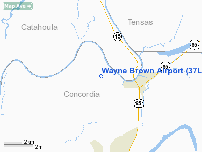
Wayne Brown Airport
Address:
Concordia Parish, LA
Tel:
601-636-6778,
318-757-4235
Images
and information placed above are from
http://www.airport-data.com/airport/37LA/
We
thank them for the data!
|
General Info |
| Country |
United
States |
| State |
LOUISIANA |
| FAA ID |
37LA
|
| Latitude |
31-43-39.594N |
|
Longitude |
091-34-58.438W |
|
Elevation |
59 feet
|
| Near
City |
CLAYTON
|
We don't guarantee the information is fresh and accurate. The data may
be wrong or outdated.
For more up-to-date information please refer to other sources.
|
|


