 |
|
|
Location &
QuickFacts
|
FAA
Information Effective: |
2008-09-25 |
|
Airport
Identifier: |
LS45 |
|
Airport
Status: |
Operational |
|
Longitude/Latitude: |
090-28-02.3010W/29-59-07.7340N
-90.467306/29.985482 (Estimated) |
|
Elevation: |
15 ft / 4.57 m (Estimated) |
|
Land: |
0 acres |
|
From
nearest city: |
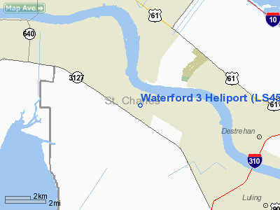
1 nautical miles W of Killona, LA |
|
Location: |
St Charles Parish, LA |
|
Magnetic Variation: |
03E (1985) |
Owner & Manager
|
Ownership: |
Privately owned |
|
Owner: |
Louisiana Power & Light |
|
Address: |
P.o. Box 6008
New Orleans, LA 70174-6008 |
|
Phone number: |
504-363-8737 |
|
Manager: |
M. Ferri |
|
Address: |
|
|
Phone number: |
504-739-6489 |
Airport
Operations and Facilities
|
Airport
Use: |
Private |
|
Wind
indicator: |
Yes |
|
Segmented Circle: |
No |
|
Control
Tower: |
No |
|
Lighting
Schedule: |
DUSK-DAWN |
|
Sectional chart: |
New Orleans |
|
Region: |
ASW - Southwest |
|
Boundary
ARTCC: |
ZHU - Houston |
|
Tie-in
FSS: |
DRI - De Ridder |
|
FSS Toll
Free: |
1-800-WX-BRIEF |
|
Runway Information
Helipad H1
|
Dimension: |
50 x 50 ft / 15.2 x 15.2 m |
|
Surface: |
CONC, Good Condition |
|
|
Runway H1
|
Runway
|
|
Traffic
Pattern: |
Left |
Left |
|
Radio Navigation Aids
|
ID |
Type |
Name |
Ch |
Freq |
Var |
Dist |
|
MS |
NDB |
Kinte |
|
338.00 |
03E |
4.2 nm |
|
DEF |
NDB |
Slidell |
|
256.00 |
03E |
37.9 nm |
|
FNA |
NDB |
Florenville |
|
371.00 |
03E |
42.4 nm |
|
PTN |
NDB |
Patterson |
|
245.00 |
01E |
48.2 nm |
|
HMU |
VOR |
Hammond |
|
109.60 |
03E |
32.2 nm |
|
RQR |
VOR/DME |
Reserve |
045X |
110.80 |
02E |
8.8 nm |
|
HRV |
VORTAC |
Harvey |
088X |
114.10 |
02E |
25.5 nm |
|
TBD |
VORTAC |
Tibby |
057X |
112.00 |
02E |
27.0 nm |
|
NEW |
VOT |
New Orleans Lakefront |
|
111.00 |
|
23.2 nm |
Remarks
-
MET. TOWERS WITH
MARKERBALLS AND NMRS ELECTRICAL TWRS IN IMMEDIATE AREA.
Waterford 3 Heliport
Address:
St Charles Parish, LA
Tel:
504-363-8737, 504-739-6489
Images
and information placed above are from
http://www.airport-data.com/airport/LS45/
We
thank them for the data!
|
General Info |
| Country |
United
States |
| State |
LOUISIANA |
| FAA ID |
LS45
|
| Latitude |
29-59-07.734N |
|
Longitude |
090-28-02.301W |
|
Elevation |
15 feet
|
| Near
City |
KILLONA
|
We don't guarantee the information is fresh and accurate. The data may
be wrong or outdated.
For more up-to-date information please refer to other sources.
|
|


