 |
|
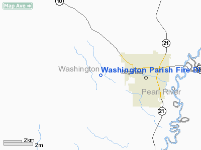
Washington Parish Fire Dist 7/oep Heliport |
|
Location &
QuickFacts
|
FAA
Information Effective: |
2008-09-25 |
|
Airport
Identifier: |
28LA |
|
Airport
Status: |
Operational |
|
Longitude/Latitude: |
089-55-00.0000W/30-47-00.0000N
-89.916667/30.783333 (Estimated) |
|
Elevation: |
146 ft / 44.50 m (Estimated) |
|
Land: |
2 acres |
|
From
nearest city: |
3 nautical miles W of Bogalusa, LA |
|
Location: |
Washington Parish, LA |
|
Magnetic Variation: |
02E (1995) |
Owner & Manager
|
Ownership: |
Privately owned |
|
Owner: |
Washington Parish Fire Dist 7
O.E.P. |
|
Address: |
17380 Bill Booty Rd
Bogalusa, LA 70427 |
|
Phone
number: |
504-732-5200 |
|
Manager: |
Sidney Warner Sr |
|
Address: |
17380 Bill Booty Rd
Bogalusa, LA 70427 |
|
Phone number: |
504-732-5200 |
Airport Operations and Facilities
|
Airport
Use: |
Private |
|
Segmented Circle: |
No |
|
Control
Tower: |
No |
|
Sectional chart: |
New Orleans |
|
Region: |
ASW - Southwest |
|
Boundary
ARTCC: |
ZHU - Houston |
|
Tie-in
FSS: |
DRI - De Ridder |
|
FSS on
Airport: |
No |
|
FSS Toll
Free: |
1-800-WX-BRIEF |
|
Runway Information
Helipad H1
|
Dimension: |
40 x 40 ft / 12.2 x 12.2 m |
|
Surface: |
CONC, |
|
|
Runway H1
|
Runway
|
|
Traffic
Pattern: |
Left |
Left |
|
Radio Navigation Aids
|
ID |
Type |
Name |
Ch |
Freq |
Var |
Dist |
|
BX |
NDB |
Carma |
|
353.00 |
02E |
6.5 nm |
|
MJD |
NDB |
Picayune |
|
276.00 |
01E |
22.1 nm |
|
FNA |
NDB |
Florenville |
|
371.00 |
03E |
22.7 nm |
|
DEF |
NDB |
Slidell |
|
256.00 |
03E |
29.6 nm |
|
HS |
NDB |
Hanco |
|
221.00 |
01E |
31.1 nm |
|
AYI |
NDB |
Hanco |
|
221.00 |
03E |
31.1 nm |
|
FOH |
NDB |
Foxworth |
|
331.00 |
05E |
31.2 nm |
|
MC |
NDB |
Ferni |
|
413.00 |
03E |
41.7 nm |
|
HMU |
VOR |
Hammond |
|
109.60 |
03E |
30.4 nm |
|
PCU |
VOR/DME |
Picayune |
059X |
112.20 |
05E |
16.5 nm |
|
GPT |
VOR/DME |
Gulfport |
27X |
109.00 |
02E |
49.1 nm |
|
MCB |
VORTAC |
Mc Comb |
114X |
116.70 |
03E |
35.9 nm |
|
LBY |
VORTAC |
Eaton |
043X |
110.60 |
05E |
48.4 nm |
|
NEW |
VOT |
New Orleans Lakefront |
|
111.00 |
|
45.1 nm |
Washington Parish Fire Dist 7/oep
Heliport
Address:
Washington Parish, LA
Tel:
504-732-5200
Images
and information placed above are from
http://www.airport-data.com/airport/28LA/
We
thank them for the data!
|
General Info |
| Country |
United
States |
| State |
LOUISIANA |
| FAA ID |
28LA
|
| Latitude |
30-47-00.000N |
|
Longitude |
089-55-00.000W |
|
Elevation |
146 feet
|
| Near
City |
BOGALUSA
|
We don't guarantee the information is fresh and accurate. The data may
be wrong or outdated.
For more up-to-date information please refer to other sources.
|
|


