 |
|
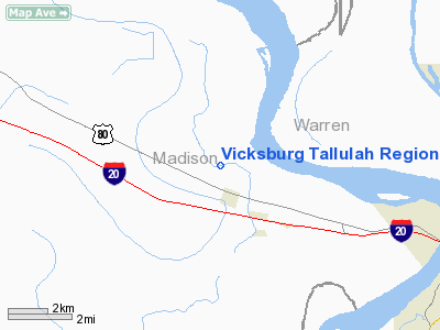
Vicksburg Tallulah Regional Airport |
|
|
|
Location &
QuickFacts
|
FAA
Information Effective: |
2008-09-25 |
|
Airport
Identifier: |
TVR |
|
Airport
Status: |
Operational |
|
Longitude/Latitude: |
091-01-39.6810W/32-21-05.7830N
-91.027689/32.351606 (Estimated) |
|
Elevation: |
86 ft / 26.21 m (Estimated) |
|
Land: |
240 acres |
|
From
nearest city: |
9 nautical miles E of Tallulah/vicksburg, Ms, LA |
|
Location: |
Madison Parish, LA |
|
Magnetic Variation: |
02E (1995) |
Owner & Manager
|
Ownership: |
Publicly owned |
|
Owner: |
Vicksburg-tallulah District
AIRPORT BOARD. |
|
Address: |
175 Vtr Airport Rd.
Tallulah, LA 71282 |
|
Phone
number: |
318-574-5841 |
|
Manager: |
Randy Woods |
|
Address: |
175 Vtr Airport Rd.
Tallulah, LA 71282 |
|
Phone number: |
318-574-5841 |
Airport Operations and Facilities
|
Airport
Use: |
Open to public |
|
Wind
indicator: |
Yes |
|
Segmented Circle: |
Yes |
|
Control
Tower: |
No |
|
Lighting
Schedule: |
DUSK-DAWN
MIRL RY 18/36 PRESET LOW INTST; TO INCR INTST ACTVT - CTAF. |
|
Beacon
Color: |
Clear-Green (lighted land airport) |
|
Sectional chart: |
Memphis |
|
Region: |
ASW - Southwest |
|
Traffic
Pattern Alt: |
1000 ft |
|
Boundary
ARTCC: |
ZME - Memphis |
|
Tie-in
FSS: |
DRI - De Ridder |
|
FSS on
Airport: |
No |
|
FSS Toll
Free: |
1-800-WX-BRIEF |
|
NOTAMs
Facility: |
TVR (NOTAM-d service avaliable) |
|
Federal Agreements: |
NGY |
Airport Communications
|
CTAF: |
123.000 |
|
Unicom: |
123.000 |
Airport Services
|
Fuel
available: |
100LLA
FOR FUEL AFT HRS CALL 318-366-1615. |
|
Airframe
Repair: |
MAJOR |
|
Power
Plant Repair: |
MAJOR |
|
Bulk
Oxygen: |
HIGH |
|
Runway Information
Runway 18/36
|
Dimension: |
5002 x 100 ft / 1524.6 x 30.5 m |
|
Surface: |
ASPH, Good Condition |
|
Weight Limit: |
Single wheel: 60000 lbs.
Dual wheel: 75000 lbs. |
|
Edge Lights: |
Medium |
|
|
Runway 18
|
Runway 36
|
|
Longitude: |
091-01-40.1170W |
091-01-39.2440W |
|
Latitude: |
32-21-30.5270N |
32-20-41.0400N |
|
Elevation: |
85.00 ft |
86.00 ft |
|
Alignment: |
127 |
127 |
|
ILS Type: |
|
LOCALIZER |
|
Traffic
Pattern: |
Left |
Left |
|
Markings: |
Non-precision instrument, Good Condition |
Non-precision instrument, Good Condition |
|
Crossing
Height: |
29.00 ft |
29.00 ft |
|
VASI: |
2-light PAPI on left side |
2-light PAPI on left side |
|
Visual
Glide Angle: |
3.33° |
3.33° |
|
Obstruction: |
80 ft trees, 2500.0 ft from runway, 100 ft right of
centerline, 28:1 slope to clear |
35 ft pline, 1650.0 ft from runway, 41:1 slope to clear |
|
Decleard
distances: |
Take off run available 5002.00 ft
Take off distance available 5002.00 ft
Actual stop distance available 5002.00 ft
Landing distance available 5002.00 ft |
Take off run available 5002.00 ft
Take off distance available 5002.00 ft
Actual stop distance available 5002.00 ft
Landing distance available 5002.00 ft |
|
Radio Navigation Aids
|
ID |
Type |
Name |
Ch |
Freq |
Var |
Dist |
|
TV |
NDB |
Savry |
|
344.00 |
02E |
6.4 nm |
|
VKS |
NDB |
Vicksburg |
|
382.00 |
03E |
8.8 nm |
|
BLE |
NDB |
Lake Providence |
|
278.00 |
03E |
29.9 nm |
|
RYB |
NDB |
Raymond |
|
375.00 |
03E |
31.4 nm |
|
MRK |
NDB |
Molly Ridge |
|
338.00 |
02E |
38.0 nm |
|
JH |
NDB |
Brenz |
|
260.00 |
02E |
39.1 nm |
|
HAH |
NDB |
Natchez-adams County |
|
388.00 |
03E |
42.0 nm |
|
BQP |
NDB |
Bastrop |
|
329.00 |
03E |
49.7 nm |
|
HEZ |
VOR/DME |
Natchez |
037X |
110.00 |
03E |
46.2 nm |
|
JAN |
VORTAC |
Jackson |
073X |
112.60 |
05E |
44.6 nm |
|
JAN |
VOT |
Jackson |
|
111.00 |
|
48.9 nm |
Remarks
-
CROP DUSTING
ACTIVITY 2 NM RADIUS OF ARPT.
-
PILOTS IN TFC
PATTERN ARE REQUESTED TO AVOID OVER FLIGHT OF MOUND LA 1/2 MI SOUTH & EAST OF
RY 36.
-
MIGRATORY BIRDS INVOF ARPT.
-
GCO AVBL ON FREQ
135.075 THRU DRI AFSS.
-
SEE PROJECT FILE
ON ARPT IN ASW REGION.
Based Aircraft
|
Aircraft based
on field: |
23 |
|
Single Engine
Airplanes: |
15 |
|
Multi Engine
Airplanes: |
5 |
|
Jet Engine
Airplanes: |
1 |
|
Helicopters: |
1 |
|
Military: |
1 |
Operational Statistics
Time Period: 2006-08-29 - 2007-08-28
|
Aircraft
Operations: |
149/Week |
|
General
Aviation Local: |
32.3% |
|
General
Aviation Itinerant: |
62.1% |
|
Military: |
5.6% |
Vicksburg Tallulah Regional Airport
Address:
Madison Parish, LA
Tel:
318-574-5841
Images
and information placed above are from
http://www.airport-data.com/airport/TVR/
We
thank them for the data!
|
General Info |
| Country |
United
States |
| State |
LOUISIANA |
| FAA ID |
TVR
|
| Latitude |
32-21-05.783N |
|
Longitude |
091-01-39.681W |
|
Elevation |
86 feet
|
| Near
City |
TALLULAH/VICKSBURG, MS |
We don't guarantee the information is fresh and accurate. The data may
be wrong or outdated.
For more up-to-date information please refer to other sources.
|
|


