 |
|
|
|
|
|
|
Location &
QuickFacts
|
FAA
Information Effective: |
2008-09-25 |
|
Airport
Identifier: |
LA92 |
|
Airport
Status: |
Operational |
|
Longitude/Latitude: |
090-43-14.3220W/29-22-22.7960N
-90.720645/29.372999 (Estimated) |
|
Elevation: |
0 ft / 0.00 m (Estimated) |
|
Land: |
5 acres |
|
From
nearest city: |
1 nautical miles SW of Dulac, LA |
|
Location: |
Terrebonne Parish, LA |
|
Magnetic Variation: |
03E (1985) |
Owner & Manager
|
Ownership: |
Privately owned |
|
Owner: |
Union Oil Co. |
|
Address: |
P.o. Box 320
Dulac, LA 70353 |
|
Phone
number: |
504-563-3500 |
|
Manager: |
Tim Creswell |
|
Address: |
P.o. Box 320
Dulac, LA 70353 |
|
Phone number: |
504-563-3500 |
Airport Operations and Facilities
|
Airport
Use: |
Private |
|
Wind
indicator: |
Yes |
|
Segmented Circle: |
No |
|
Control
Tower: |
No |
|
Lighting
Schedule: |
PHONE REQ
FOR PERIMETER LGTS CALL 504-563-3500. |
|
Landing fee charge: |
No |
|
Sectional chart: |
New Orleans |
|
Region: |
ASW - Southwest |
|
Boundary ARTCC: |
ZHU - Houston |
|
Tie-in FSS: |
DRI - De Ridder |
|
FSS on Airport: |
No |
|
FSS Toll Free: |
1-800-WX-BRIEF |
Airport Services
|
Airframe
Repair: |
NONE |
|
Power
Plant Repair: |
NONE |
|
Runway Information
Helipad H1
|
Dimension: |
70 x 60 ft / 21.3 x 18.3 m |
|
Surface: |
CONC, |
|
|
Runway H1
|
Runway
|
|
Traffic
Pattern: |
Left |
Left |
|
Radio Navigation Aids
|
ID |
Type |
Name |
Ch |
Freq |
Var |
Dist |
|
PTN |
NDB |
Patterson |
|
245.00 |
01E |
38.2 nm |
|
MS |
NDB |
Kinte |
|
338.00 |
03E |
42.6 nm |
|
RQR |
VOR/DME |
Reserve |
045X |
110.80 |
02E |
43.5 nm |
|
TBD |
VORTAC |
Tibby |
057X |
112.00 |
02E |
18.4 nm |
|
LEV |
VORTAC |
Leeville |
082X |
113.50 |
02E |
34.4 nm |
|
HRV |
VORTAC |
Harvey |
088X |
114.10 |
02E |
47.2 nm |
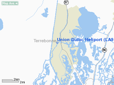
Union Dulac Heliport
Address:
Terrebonne Parish, LA
Tel:
504-563-3500
Images
and information placed above are from
http://www.airport-data.com/airport/LA92/
We
thank them for the data!
|
General Info |
| Country |
United
States |
| State |
LOUISIANA |
| FAA ID |
LA92
|
| Latitude |
29-22-22.796N |
|
Longitude |
090-43-14.322W |
|
Elevation |
0 feet
|
| Near
City |
DULAC
|
We don't guarantee the information is fresh and accurate. The data may
be wrong or outdated.
For more up-to-date information please refer to other sources.
|
|


