 |
|
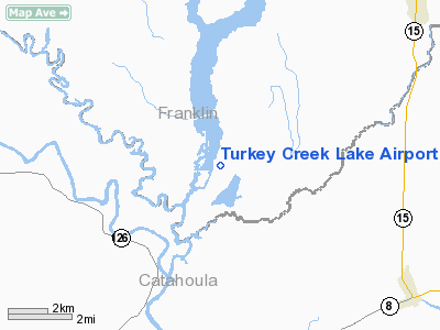
Turkey Creek Lake Airport |
|
Location &
QuickFacts
|
FAA
Information Effective: |
2008-09-25 |
|
Airport
Identifier: |
9LA1 |
|
Airport
Status: |
Operational |
|
Longitude/Latitude: |
091-45-33.4580W/31-54-24.5790N
-91.759294/31.906827 (Estimated) |
|
Elevation: |
67 ft / 20.42 m (Estimated) |
|
Land: |
0 acres |
|
From
nearest city: |
6 nautical miles SW of Wisner, LA |
|
Location: |
Franklin Parish, LA |
|
Magnetic Variation: |
04E (1985) |
Owner & Manager
|
Ownership: |
Privately owned |
|
Owner: |
K.c. Brown |
|
Address: |
Route 1, Box 79
Wisner, LA 71378 |
|
Phone number: |
318-724-7696 |
|
Manager: |
K.c.brown |
|
Address: |
Route 1, Box 79
Wisner, LA 71378 |
|
Phone number: |
318-724-7696 |
Airport Operations and Facilities
|
Airport Use: |
Private |
|
Wind indicator: |
No |
|
Segmented Circle: |
No |
|
Control Tower: |
No |
|
Landing fee charge: |
No |
|
Sectional chart: |
Houston |
|
Region: |
ASW - Southwest |
|
Boundary ARTCC: |
ZHU - Houston |
|
Tie-in FSS: |
DRI - De Ridder |
|
FSS on Airport: |
No |
|
FSS Toll Free: |
1-800-WX-BRIEF |
Airport Services
|
Airframe
Repair: |
NONE |
|
Power
Plant Repair: |
NONE |
|
Runway Information
Runway 02/20
|
Dimension: |
2600 x 70 ft / 792.5 x 21.3 m |
|
Surface: |
TURF, |
|
|
Runway 02
|
Runway 20
|
|
Traffic
Pattern: |
Left |
Left |
|
Radio Navigation Aids
|
ID |
Type |
Name |
Ch |
Freq |
Var |
Dist |
|
HAH |
NDB |
Natchez-adams County |
|
388.00 |
03E |
27.1 nm |
|
MRK |
NDB |
Molly Ridge |
|
338.00 |
02E |
30.1 nm |
|
TV |
NDB |
Savry |
|
344.00 |
02E |
42.5 nm |
|
IFJ |
NDB |
Winnfield |
|
402.00 |
04E |
45.9 nm |
|
VKS |
NDB |
Vicksburg |
|
382.00 |
03E |
46.7 nm |
|
HEZ |
VOR/DME |
Natchez |
037X |
110.00 |
03E |
29.2 nm |
|
SWB |
VOR/DME |
Sawmill |
84Y |
113.75 |
02E |
47.0 nm |
|
MLU |
VORTAC |
Monroe |
119X |
117.20 |
03E |
39.3 nm |
Based Aircraft
|
Aircraft based
on field: |
3 |
|
Single Engine
Airplanes: |
3 |
Turkey Creek Lake Airport
Address:
Franklin Parish, LA
Tel:
318-724-7696
Images
and information placed above are from
http://www.airport-data.com/airport/9LA1/
We
thank them for the data!
|
General Info |
| Country |
United
States |
| State |
LOUISIANA |
| FAA ID |
9LA1
|
| Latitude |
31-54-24.579N |
|
Longitude |
091-45-33.458W |
|
Elevation |
67 feet
|
| Near
City |
WISNER
|
We don't guarantee the information is fresh and accurate. The data may
be wrong or outdated.
For more up-to-date information please refer to other sources.
|
|


