 |
|
|
Location &
QuickFacts
|
FAA
Information Effective: |
2008-09-25 |
|
Airport
Identifier: |
54LA |
|
Airport
Status: |
Operational |
|
Longitude/Latitude: |
091-02-18.3740W/30-33-45.6750N
-91.038437/30.562687 (Estimated) |
|
Elevation: |
69 ft / 21.03 m (Estimated) |
|
Land: |
0 acres |
|
From
nearest city: |
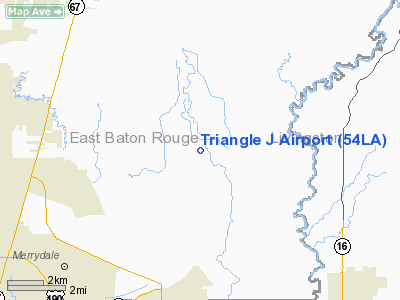
9 nautical miles NE of Baton Rouge, LA |
|
Location: |
East Baton Rouge Parish, LA |
|
Magnetic Variation: |
03E (1985) |
Owner & Manager
|
Ownership: |
Privately owned |
|
Owner: |
Dr. Virgil T. Jackson, Jr. |
|
Address: |
12636 Sullivan Rd.
Baton Rouge, LA 70805 |
|
Phone
number: |
504-261-3616 |
|
Manager: |
Dr. Virgil T. Jackson, Jr. |
|
Address: |
12636 Sullivan Rd.
Baton Rouge, LA 70805 |
|
Phone number: |
504-261-3616 |
Airport Operations and Facilities
|
Airport
Use: |
Private |
|
Wind
indicator: |
Yes |
|
Segmented Circle: |
No |
|
Control
Tower: |
No |
|
Landing
fee charge: |
No |
|
Sectional chart: |
Houston |
|
Region: |
ASW - Southwest |
|
Boundary
ARTCC: |
ZHU - Houston |
|
Tie-in
FSS: |
DRI - De Ridder |
|
FSS on
Airport: |
No |
|
FSS Toll
Free: |
1-800-WX-BRIEF |
|
Runway Information
Runway 05/23
|
Dimension: |
1800 x 25 ft / 548.6 x 7.6 m |
|
Surface: |
TURF, |
|
|
Runway 05
|
Runway 23
|
|
Traffic
Pattern: |
Left |
Left |
|
Radio Navigation Aids
|
ID |
Type |
Name |
Ch |
Freq |
Var |
Dist |
|
HZ |
NDB |
Hazer |
|
356.00 |
04E |
23.7 nm |
|
MS |
NDB |
Kinte |
|
338.00 |
03E |
46.3 nm |
|
MC |
NDB |
Ferni |
|
413.00 |
03E |
49.7 nm |
|
HMU |
VOR |
Hammond |
|
109.60 |
03E |
32.3 nm |
|
RQR |
VOR/DME |
Reserve |
045X |
110.80 |
02E |
36.9 nm |
|
BTR |
VORTAC |
Baton Rouge |
112X |
116.50 |
06E |
14.0 nm |
Remarks
-
OWNER DESIRES
ARPT NOT TO BE CHARTED.
Based Aircraft
|
Aircraft based
on field: |
1 |
|
Single Engine
Airplanes: |
1 |
Triangle J Airport
Address:
East Baton Rouge Parish, LA
Tel:
504-261-3616
Images
and information placed above are from
http://www.airport-data.com/airport/54LA/
We
thank them for the data!
|
General Info |
| Country |
United
States |
| State |
LOUISIANA |
| FAA ID |
54LA
|
| Latitude |
30-33-45.675N |
|
Longitude |
091-02-18.374W |
|
Elevation |
69 feet
|
| Near
City |
BATON
ROUGE |
We don't guarantee the information is fresh and accurate. The data may
be wrong or outdated.
For more up-to-date information please refer to other sources.
|
|


