 |
|
|
Location &
QuickFacts
|
FAA
Information Effective: |
2008-09-25 |
|
Airport
Identifier: |
LA63 |
|
Airport
Status: |
Operational |
|
Longitude/Latitude: |
091-49-51.0000W/32-58-18.0000N
-91.830833/32.971667 (Estimated) |
|
Elevation: |
122 ft / 37.19 m (Estimated) |
|
Land: |
10 acres |
|
From
nearest city: |
12 nautical miles NE of Bastrop, LA |
|
Location: |
Morehouse Parish, LA |
|
Magnetic Variation: |
03E (1990) |
Owner & Manager
|
Ownership: |
Privately owned |
|
Owner: |
T. E. Travis |
|
Address: |
14281 Southern Pines Dr.
Dallas, TX 75234 |
|
Phone
number: |
214-241-8102 |
|
Manager: |
T. E. Travis |
|
Address: |
14281 Southern Pines Dr.
Dallas, TX 75234 |
|
Phone number: |
214-241-8102 |
Airport Operations and Facilities
|
Airport
Use: |
Private |
|
Wind
indicator: |
Yes |
|
Segmented Circle: |
No |
|
Control
Tower: |
No |
|
Sectional chart: |
Memphis |
|
Region: |
ASW - Southwest |
|
Boundary
ARTCC: |
ZME - Memphis |
|
Tie-in
FSS: |
DRI - De Ridder |
|
FSS on
Airport: |
No |
|
FSS Toll
Free: |
1-800-WX-BRIEF |
|
Runway Information
Runway 06/24
|
Dimension: |
1500 x 20 ft / 457.2 x 6.1 m |
|
Surface: |
TURF,
SFC SOFT & MUDDY WHEN WET. |
|
|
Runway 06
|
Runway 24
|
|
Traffic
Pattern: |
Left |
Left |
|
Obstruction: |
4 ft fence |
30 ft plines, 0.0 ft from runway |
|
Radio Navigation Aids
|
ID |
Type |
Name |
Ch |
Freq |
Var |
Dist |
|
BQP |
NDB |
Bastrop |
|
329.00 |
03E |
13.3 nm |
|
BLE |
NDB |
Lake Providence |
|
278.00 |
03E |
33.4 nm |
|
MRK |
NDB |
Molly Ridge |
|
338.00 |
02E |
34.1 nm |
|
REN |
NDB |
Warren |
|
226.00 |
04E |
37.1 nm |
|
ROQ |
NDB |
Ruston |
|
368.00 |
03E |
44.1 nm |
|
MON |
VOR/DME |
Monticello |
053X |
111.60 |
04E |
36.0 nm |
|
MLU |
VORTAC |
Monroe |
119X |
117.20 |
03E |
29.2 nm |
|
ELD |
VORTAC |
El Dorado |
102X |
115.50 |
07E |
49.0 nm |
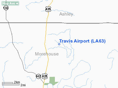
Travis Airport
Address:
Morehouse Parish, LA
Tel:
214-241-8102
Images
and information placed above are from
http://www.airport-data.com/airport/LA63/
We
thank them for the data!
|
General Info |
| Country |
United
States |
| State |
LOUISIANA |
| FAA ID |
LA63
|
| Latitude |
32-58-18.000N |
|
Longitude |
091-49-51.000W |
|
Elevation |
122 feet
|
| Near
City |
BASTROP
|
We don't guarantee the information is fresh and accurate. The data may
be wrong or outdated.
For more up-to-date information please refer to other sources.
|
|


