 |
|
|
Location &
QuickFacts
|
FAA
Information Effective: |
2008-09-25 |
|
Airport
Identifier: |
0LS5 |
|
Airport
Status: |
Operational |
|
Longitude/Latitude: |
092-07-47.4400W/30-18-24.7200N
-92.129844/30.306867 (Estimated) |
|
Elevation: |
40 ft / 12.19 m (Estimated) |
|
Land: |
0 acres |
|
From
nearest city: |
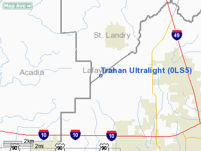
2 nautical miles S of Cankton, LA |
|
Location: |
St Landry Parish, LA |
|
Magnetic Variation: |
03E (1995) |
Owner & Manager
|
Ownership: |
Privately owned |
|
Owner: |
Harry J Trahan |
|
Address: |
142 Jules Lane
Church Point, LA 70525 |
|
Phone
number: |
318-668-4584 |
|
Manager: |
Harry J Trahan |
|
Address: |
142 Jules Lane
Church Point, LA 70525 |
|
Phone number: |
318-668-4584 |
Airport Operations and Facilities
|
Airport
Use: |
Private |
|
Segmented Circle: |
No |
|
Control
Tower: |
No |
|
Sectional chart: |
Houston |
|
Region: |
ASW - Southwest |
|
Boundary
ARTCC: |
ZHU - Houston |
|
Tie-in
FSS: |
DRI - De Ridder |
|
FSS on
Airport: |
No |
|
FSS Toll
Free: |
1-800-WX-BRIEF |
|
Runway Information
Runway 18/36
|
Dimension: |
650 x 250 ft / 198.1 x 76.2 m |
|
Surface: |
TURF, |
|
|
Runway 18
|
Runway 36
|
|
Traffic
Pattern: |
Left |
Left |
|
Obstruction: |
35 ft pline, 1236.0 ft from runway |
|
|
Radio Navigation Aids
|
ID |
Type |
Name |
Ch |
Freq |
Var |
Dist |
|
OPL |
NDB |
St Landry |
|
335.00 |
04E |
21.0 nm |
|
ECY |
NDB |
Eunice |
|
263.00 |
02E |
22.4 nm |
|
AR |
NDB |
Acadi |
|
269.00 |
03E |
25.2 nm |
|
BWK |
NDB |
Bunkie |
|
397.00 |
03E |
34.0 nm |
|
LRR |
NDB |
Allen Parish |
|
379.00 |
03E |
35.3 nm |
|
HZ |
NDB |
Hazer |
|
356.00 |
04E |
38.5 nm |
|
MKV |
NDB |
Marksville |
|
347.00 |
02E |
47.5 nm |
|
LLA |
VOR/DME |
White Lake |
041X |
110.40 |
04E |
40.7 nm |
|
LFT |
VORTAC |
Lafayette |
035X |
109.80 |
03E |
9.8 nm |
|
BTR |
VORTAC |
Baton Rouge |
112X |
116.50 |
06E |
44.6 nm |
Based Aircraft
|
Aircraft based
on field: |
1 |
|
Ultralights: |
1 |
Trahan Ultralight
Address:
St Landry Parish, LA
Tel:
318-668-4584
Images
and information placed above are from
http://www.airport-data.com/airport/0LS5/
We
thank them for the data!
|
General Info |
| Country |
United
States |
| State |
LOUISIANA |
| FAA ID |
0LS5
|
| Latitude |
30-18-24.720N |
|
Longitude |
092-07-47.440W |
|
Elevation |
40 feet
|
| Near
City |
CANKTON
|
We don't guarantee the information is fresh and accurate. The data may
be wrong or outdated.
For more up-to-date information please refer to other sources.
|
|


