 |
|
|
Location &
QuickFacts
|
FAA
Information Effective: |
2008-09-25 |
|
Airport
Identifier: |
LS24 |
|
Airport
Status: |
Operational |
|
Longitude/Latitude: |
090-05-36.2610W/29-55-30.7370N
-90.093406/29.925205 (Estimated) |
|
Elevation: |
50 ft / 15.24 m (Estimated) |
|
Land: |
0 acres |
|
From
nearest city: |
0 nautical miles N of New Orleans, LA |
|
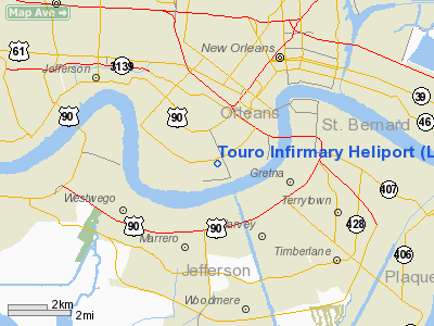
Location: |
Orleans Parish, LA |
|
Magnetic Variation: |
03E (1980) |
Owner & Manager
|
Ownership: |
Privately owned |
|
Owner: |
Touro Infirmary |
|
Address: |
1401 Foucher St
New Orleans, LA 70115 |
|
Phone
number: |
504-897-8280 |
|
Manager: |
Scott C. Landry |
|
Address: |
1401 Foucher St
New Orleans, LA 70115 |
|
Phone number: |
504-897-8280 |
Airport Operations and Facilities
|
Airport Use: |
Private
MEDICAL. |
|
Wind indicator: |
Yes |
|
Segmented Circle: |
No |
|
Control Tower: |
No |
|
Sectional chart: |
New Orleans |
|
Region: |
ASW - Southwest |
|
Boundary ARTCC: |
ZHU - Houston |
|
Tie-in FSS: |
DRI - De Ridder |
|
FSS Toll Free: |
1-800-WX-BRIEF |
Airport
Communications
|
Runway Information
Helipad H1
|
Dimension: |
66 x 48 ft / 20.1 x 14.6 m |
|
Surface: |
CONC,
ROOFTOP. |
|
|
Runway H1
|
Runway
|
|
Traffic
Pattern: |
Left |
Left |
|
Radio Navigation Aids
|
ID |
Type |
Name |
Ch |
Freq |
Var |
Dist |
|
MS |
NDB |
Kinte |
|
338.00 |
03E |
17.1 nm |
|
DEF |
NDB |
Slidell |
|
256.00 |
03E |
26.1 nm |
|
FNA |
NDB |
Florenville |
|
371.00 |
03E |
32.7 nm |
|
MJD |
NDB |
Picayune |
|
276.00 |
01E |
41.2 nm |
|
AYI |
NDB |
Hanco |
|
221.00 |
03E |
45.8 nm |
|
HS |
NDB |
Hanco |
|
221.00 |
01E |
45.8 nm |
|
HMU |
VOR |
Hammond |
|
109.60 |
03E |
39.5 nm |
|
RQR |
VOR/DME |
Reserve |
045X |
110.80 |
02E |
27.6 nm |
|
PCU |
VOR/DME |
Picayune |
059X |
112.20 |
05E |
42.6 nm |
|
HRV |
VORTAC |
Harvey |
088X |
114.10 |
02E |
6.5 nm |
|
TBD |
VORTAC |
Tibby |
057X |
112.00 |
02E |
41.5 nm |
|
LEV |
VORTAC |
Leeville |
082X |
113.50 |
02E |
45.1 nm |
|
NEW |
VOT |
New Orleans Lakefront |
|
111.00 |
|
7.7 nm |
Remarks
-
PVDD LGT POLES
ARE RELOCATED TO PROVIDE CLEAR APP/DEP AREAS; UNAUTHORIZED ACCESS IS PRECLUDED
DURG OPN.
Touro Infirmary Heliport
Address:
Orleans Parish, LA
Tel:
504-897-8280
Images
and information placed above are from
http://www.airport-data.com/airport/LS24/
We
thank them for the data!
|
General Info |
| Country |
United
States |
| State |
LOUISIANA |
| FAA ID |
LS24
|
| Latitude |
29-55-30.737N |
|
Longitude |
090-05-36.261W |
|
Elevation |
50 feet
|
| Near
City |
NEW
ORLEANS |
We don't guarantee the information is fresh and accurate. The data may
be wrong or outdated.
For more up-to-date information please refer to other sources.
|
|


