 |
|
|
|
|
|
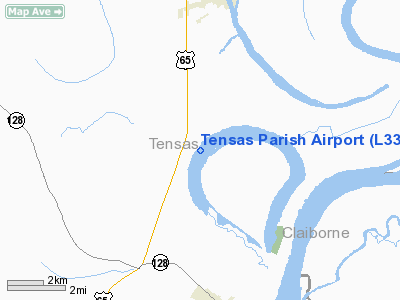
Location &
QuickFacts
|
FAA
Information Effective: |
2008-09-25 |
|
Airport
Identifier: |
L33 |
|
Airport
Status: |
Operational |
|
Longitude/Latitude: |
091-14-50.4050W/31-59-50.5650N
-91.247335/31.997379 (Estimated) |
|
Elevation: |
74 ft / 22.56 m (Surveyed) |
|
Land: |
15 acres |
|
From
nearest city: |
4 nautical miles NE of St Joseph, LA |
|
Location: |
Tensas Parish, LA |
|
Magnetic Variation: |
04E (1985) |
Owner & Manager
|
Ownership: |
Publicly owned |
|
Owner: |
Tensas Parish Police Jury |
|
Address: |
Po Box 6168
St Joseph, LA 71366 |
|
Phone number: |
318-766-3542 |
|
Manager: |
Sonny Kifer |
|
Address: |
Po Box 177
Newellton, LA 71357 |
|
Phone number: |
318-467-5245 |
Airport
Operations and Facilities
|
Airport
Use: |
Open to public |
|
Wind
indicator: |
Yes |
|
Segmented Circle: |
No |
|
Control
Tower: |
No |
|
Lighting
Schedule: |
DUSK-DAWN
MIRL RY 16/34 PRESET LOW INTST; TO INCR INTST ACTVT - CTAF. |
|
Beacon
Color: |
Clear-Green (lighted land airport) |
|
Landing
fee charge: |
No |
|
Sectional chart: |
Houston |
|
Region: |
ASW - Southwest |
|
Boundary
ARTCC: |
ZME - Memphis |
|
Tie-in
FSS: |
DRI - De Ridder |
|
FSS on
Airport: |
No |
|
FSS Toll
Free: |
1-800-WX-BRIEF |
|
NOTAMs
Facility: |
DRI (NOTAM-d service avaliable) |
Airport Communications
Airport Services
|
Runway Information
Runway 16/34
|
Dimension: |
3500 x 75 ft / 1066.8 x 22.9 m |
|
Surface: |
ASPH, Good Condition |
|
Weight Limit: |
Single wheel: 12000 lbs. |
|
Edge Lights: |
Medium |
|
|
Runway 16
|
Runway 34
|
|
Traffic
Pattern: |
Left |
Left |
|
Markings: |
Basic, Good Condition |
Basic, Good Condition |
|
Obstruction: |
15 ft road, 435.0 ft from runway, 15:1 slope to clear |
50 ft trees, 1200.0 ft from runway, 20:1 slope to clear
CROP LINE 190 FT FM RY END & 150 FT FM SIDES OF RY. |
|
Radio Navigation Aids
|
ID |
Type |
Name |
Ch |
Freq |
Var |
Dist |
|
HAH |
NDB |
Natchez-adams County |
|
388.00 |
03E |
18.6 nm |
|
TV |
NDB |
Savry |
|
344.00 |
02E |
18.7 nm |
|
VKS |
NDB |
Vicksburg |
|
382.00 |
03E |
21.6 nm |
|
MRK |
NDB |
Molly Ridge |
|
338.00 |
02E |
36.3 nm |
|
RYB |
NDB |
Raymond |
|
375.00 |
03E |
46.3 nm |
|
BVV |
NDB |
Brookhaven |
|
407.00 |
03E |
48.7 nm |
|
HEZ |
VOR/DME |
Natchez |
037X |
110.00 |
03E |
22.9 nm |
Remarks
-
TFC PATTERN
OERATIONS AT ST JOSEPH MUNI CONDUCTED ON W SIDE OF RY OR ALL TFC PATTERN
OPERATIONS AT HUNTER MAY ARPT CONDUCTED E SIDE RY.
Based Aircraft
|
Aircraft based
on field: |
11 |
|
Single Engine
Airplanes: |
10 |
|
Ultralights: |
1 |
Operational Statistics
Time Period: 2006-08-28 - 2007-08-27
|
Aircraft
Operations: |
135/Week |
|
General
Aviation Local: |
57.1% |
|
General
Aviation Itinerant: |
42.9% |
Tensas Parish Airport
Address:
Tensas Parish, LA
Tel:
318-766-3542, 318-467-5245
Images
and information placed above are from
http://www.airport-data.com/airport/L33/
We
thank them for the data!
|
General Info |
| Country |
United
States |
| State |
LOUISIANA |
| FAA ID |
L33
|
| Latitude |
31-59-50.565N |
|
Longitude |
091-14-50.405W |
|
Elevation |
74 feet
|
| Near
City |
ST
JOSEPH |
We don't guarantee the information is fresh and accurate. The data may
be wrong or outdated.
For more up-to-date information please refer to other sources.
|
|


