 |
|
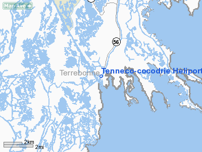
Tenneco-cocodrie Heliport |
Location &
QuickFacts
|
FAA
Information Effective: |
2008-09-25 |
|
Airport
Identifier: |
LA86 |
|
Airport
Status: |
Operational |
|
Longitude/Latitude: |
090-39-57.3170W/29-14-13.8150N
-90.665921/29.237171 (Estimated) |
|
Elevation: |
3 ft / 0.91 m (Estimated) |
|
Land: |
0 acres |
|
From
nearest city: |
0 nautical miles SW of Cocodrie, LA |
|
Location: |
Terrebonne Parish, LA |
|
Magnetic Variation: |
03E (1985) |
Owner & Manager
|
Ownership: |
Privately owned |
|
Owner: |
Tennessee Gas Pipeline |
|
Address: |
8166 Hwy 56 South
Chauvin, LA 70344 |
|
Phone number: |
504-594-2869 |
|
Manager: |
Don Haas |
|
Address: |
8166 Hwy 56 South
Chauvin, LA 70344 |
|
Phone number: |
985-594-6543 |
Airport Operations and Facilities
|
Airport Use: |
Private |
|
Wind indicator: |
Yes |
|
Segmented Circle: |
No |
|
Control Tower: |
No |
|
Landing fee charge: |
No |
|
Sectional chart: |
New Orleans |
|
Region: |
ASW - Southwest |
|
Boundary ARTCC: |
ZHU - Houston |
|
Tie-in FSS: |
DRI - De Ridder |
|
FSS on Airport: |
No |
|
FSS Toll Free: |
1-800-WX-BRIEF |
Airport Services
|
Airframe
Repair: |
NONE |
|
Power
Plant Repair: |
NONE |
|
Runway Information
Helipad H1
|
Dimension: |
20 x 20 ft / 6.1 x 6.1 m |
|
Surface: |
CONC, |
|
|
Runway H1
|
Runway
|
|
Traffic
Pattern: |
Left |
Left |
|
Radio Navigation Aids
|
ID |
Type |
Name |
Ch |
Freq |
Var |
Dist |
|
PTN |
NDB |
Patterson |
|
245.00 |
01E |
45.3 nm |
|
MS |
NDB |
Kinte |
|
338.00 |
03E |
49.4 nm |
|
TBD |
VORTAC |
Tibby |
057X |
112.00 |
02E |
27.1 nm |
|
LEV |
VORTAC |
Leeville |
082X |
113.50 |
02E |
29.7 nm |
Remarks
-
HELIPORT BUILT
OUT OVER WATER.
-
INGRESS/EGRESS SW/SE/NE
Based Aircraft
|
Aircraft based
on field: |
1 |
|
Helicopters: |
1 |
Tenneco-cocodrie Heliport
Address:
Terrebonne Parish, LA
Tel:
504-594-2869, 985-594-6543
Images
and information placed above are from
http://www.airport-data.com/airport/LA86/
We
thank them for the data!
|
General Info |
| Country |
United
States |
| State |
LOUISIANA |
| FAA ID |
LA86
|
| Latitude |
29-14-13.815N |
|
Longitude |
090-39-57.317W |
|
Elevation |
3 feet
|
| Near
City |
COCODRIE
|
We don't guarantee the information is fresh and accurate. The data may
be wrong or outdated.
For more up-to-date information please refer to other sources.
|
|


