 |
|
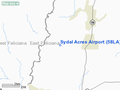
Location &
QuickFacts
|
FAA
Information Effective: |
2008-09-25 |
|
Airport
Identifier: |
58LA |
|
Airport
Status: |
Operational |
|
Longitude/Latitude: |
091-10-00.3860W/30-55-10.6450N
-91.166774/30.919624 (Estimated) |
|
Elevation: |
200 ft / 60.96 m (Estimated) |
|
Land: |
0 acres |
|
From
nearest city: |
6 nautical miles E of Wilson, LA |
|
Location: |
East Feliciana Parish, LA |
|
Magnetic Variation: |
03E (1985) |
Owner & Manager
|
Ownership: |
Privately owned |
|
Owner: |
Wilbur A. Womack, Jr. |
|
Address: |
5374 Hwy 952
Jackson, LA 70748 |
|
Phone number: |
504-629-4741 |
|
Manager: |
Wilbur A. Womack, Jr. |
|
Address: |
5374 Hwy 952
Jackson, LA 70748 |
|
Phone number: |
504-629-4741 |
Airport Operations and Facilities
|
Airport Use: |
Private |
|
Wind indicator: |
Yes |
|
Segmented Circle: |
No |
|
Control Tower: |
No |
|
Landing fee charge: |
No |
|
Sectional chart: |
Houston |
|
Region: |
ASW - Southwest |
|
Boundary ARTCC: |
ZHU - Houston |
|
Tie-in FSS: |
DRI - De Ridder |
|
FSS on Airport: |
No |
|
FSS Toll Free: |
1-800-WX-BRIEF |
Airport Services
|
Runway Information
Runway 13/31
|
Dimension: |
2600 x 150 ft / 792.5 x 45.7 m |
|
Surface: |
TURF, |
|
|
Runway 13
|
Runway 31
|
|
Traffic
Pattern: |
Left |
Left |
|
Radio Navigation Aids
|
ID |
Type |
Name |
Ch |
Freq |
Var |
Dist |
|
HZ |
NDB |
Hazer |
|
356.00 |
04E |
24.0 nm |
|
MC |
NDB |
Ferni |
|
413.00 |
03E |
39.3 nm |
|
HAH |
NDB |
Natchez-adams County |
|
388.00 |
03E |
46.8 nm |
|
MKV |
NDB |
Marksville |
|
347.00 |
02E |
47.8 nm |
|
HMU |
VOR |
Hammond |
|
109.60 |
03E |
45.6 nm |
|
HEZ |
VOR/DME |
Natchez |
037X |
110.00 |
03E |
42.5 nm |
|
BTR |
VORTAC |
Baton Rouge |
112X |
116.50 |
06E |
26.9 nm |
Based Aircraft
|
Aircraft based
on field: |
3 |
|
Single Engine
Airplanes: |
3 |
Sydal Acres Airport
Address:
East Feliciana Parish, LA
Tel:
504-629-4741
Images
and information placed above are from
http://www.airport-data.com/airport/58LA/
We
thank them for the data!
|
General Info |
| Country |
United
States |
| State |
LOUISIANA |
| FAA ID |
58LA
|
| Latitude |
30-55-10.645N |
|
Longitude |
091-10-00.386W |
|
Elevation |
200 feet
|
| Near
City |
WILSON
|
We don't guarantee the information is fresh and accurate. The data may
be wrong or outdated.
For more up-to-date information please refer to other sources.
|
|


