 |
|
Location &
QuickFacts
|
FAA
Information Effective: |
2008-09-25 |
|
Airport
Identifier: |
LA79 |
|
Airport
Status: |
Operational |
|
Longitude/Latitude: |
090-21-28.3190W/30-43-06.6700N
-90.357866/30.718519 (Estimated) |
|
Elevation: |
180 ft / 54.86 m (Estimated) |
|
Land: |
50 acres |
|
From
nearest city: |
8 nautical miles E of Amite, LA |
|
Location: |
Tangipahoa Parish, LA |
|
Magnetic Variation: |
03E (1990) |
Owner & Manager
|
Ownership: |
Privately owned |
|
Owner: |
Keith W. Capps |
|
Address: |
22222 E. Bell Rd.
Amite, LA 70422 |
|
Phone number: |
504-748-8830 |
|
Address: |
|
Airport Operations and Facilities
|
Airport
Use: |
Private |
|
Segmented Circle: |
No |
|
Control
Tower: |
No |
|
Sectional chart: |
New Orleans |
|
Region: |
ASW - Southwest |
|
Boundary
ARTCC: |
ZHU - Houston |
|
Tie-in
FSS: |
DRI - De Ridder |
|
FSS on
Airport: |
No |
|
FSS Toll
Free: |
1-800-WX-BRIEF |
|
Runway Information
Runway 18/36
|
Dimension: |
2400 x 60 ft / 731.5 x 18.3 m |
|
Surface: |
TURF, |
|
|
Runway 18
|
Runway 36
|
|
Traffic
Pattern: |
Left |
Left |
|
Displaced
threshold: |
0.00 ft |
400.00 ft |
|
Obstruction: |
20 ft pline, 800.0 ft from runway |
4 ft fence, 0.0 ft from runway |
|
Radio Navigation Aids
|
ID |
Type |
Name |
Ch |
Freq |
Var |
Dist |
|
BX |
NDB |
Carma |
|
353.00 |
02E |
27.4 nm |
|
MC |
NDB |
Ferni |
|
413.00 |
03E |
33.2 nm |
|
FNA |
NDB |
Florenville |
|
371.00 |
03E |
33.3 nm |
|
DEF |
NDB |
Slidell |
|
256.00 |
03E |
37.1 nm |
|
MJD |
NDB |
Picayune |
|
276.00 |
01E |
38.9 nm |
|
MS |
NDB |
Kinte |
|
338.00 |
03E |
41.7 nm |
|
FOH |
NDB |
Foxworth |
|
331.00 |
05E |
44.5 nm |
|
HS |
NDB |
Hanco |
|
221.00 |
01E |
49.4 nm |
|
AYI |
NDB |
Hanco |
|
221.00 |
03E |
49.4 nm |
|
HMU |
VOR |
Hammond |
|
109.60 |
03E |
12.4 nm |
|
PCU |
VOR/DME |
Picayune |
059X |
112.20 |
05E |
33.8 nm |
|
RQR |
VOR/DME |
Reserve |
045X |
110.80 |
02E |
39.8 nm |
|
MCB |
VORTAC |
Mc Comb |
114X |
116.70 |
03E |
35.6 nm |
|
NEW |
VOT |
New Orleans Lakefront |
|
111.00 |
|
44.3 nm |
Based Aircraft
|
Aircraft based
on field: |
1 |
|
Single Engine
Airplanes: |
1 |
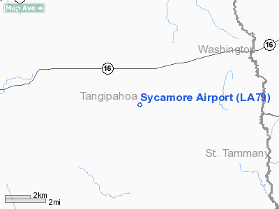
Sycamore Airport
Address:
Tangipahoa Parish, LA
Tel:
504-748-8830
Images
and information placed above are from
http://www.airport-data.com/airport/LA79/
We
thank them for the data!
|
General Info |
| Country |
United
States |
| State |
LOUISIANA |
| FAA ID |
LA79
|
| Latitude |
30-43-06.670N |
|
Longitude |
090-21-28.319W |
|
Elevation |
180 feet
|
| Near
City |
AMITE
|
We don't guarantee the information is fresh and accurate. The data may
be wrong or outdated.
For more up-to-date information please refer to other sources.
|
|


