 |
|
Location &
QuickFacts
|
FAA
Information Effective: |
2008-09-25 |
|
Airport
Identifier: |
72LA |
|
Airport
Status: |
Operational |
|
Longitude/Latitude: |
093-24-30.5630W/30-14-45.7380N
-93.408490/30.246038 (Estimated) |
|
Elevation: |
15 ft / 4.57 m (Estimated) |
|
Land: |
41 acres |
|
From
nearest city: |
2 nautical miles NW of Sulphur, LA |
|
Location: |
Calcasieu Parish, LA |
|
Magnetic Variation: |
05E (1985) |
Owner & Manager
|
Ownership: |
Publicly owned |
|
Owner: |
Dept Of Energy |
|
Address: |
800 S. Clearview Parkway
New Orleans, LA 70121 |
|
Phone
number: |
504-734-4200 |
|
Manager: |
Boeing Petroleum Services |
|
Address: |
P O Box 23
Sulphur, LA 70663 |
|
Phone number: |
318-527-8131 |
Airport Operations and Facilities
|
Airport
Use: |
Private |
|
Wind
indicator: |
Yes |
|
Segmented Circle: |
No |
|
Control
Tower: |
No |
|
Sectional chart: |
Houston |
|
Region: |
ASW - Southwest |
|
Boundary
ARTCC: |
ZHU - Houston |
|
Tie-in
FSS: |
DRI - De Ridder |
|
FSS Toll
Free: |
1-800-WX-BRIEF |
|
Runway Information
Helipad H1
|
Dimension: |
20 x 20 ft / 6.1 x 6.1 m |
|
Surface: |
CONC, |
|
|
Runway H1
|
Runway
|
|
Traffic
Pattern: |
Left |
Left |
|
Radio Navigation Aids
|
ID |
Type |
Name |
Ch |
Freq |
Var |
Dist |
|
POE |
FAN MARKER |
South |
|
|
07E |
45.8 nm |
|
UX |
NDB |
Sulfy |
|
278.00 |
04E |
2.9 nm |
|
DQU |
NDB |
De Quincy |
|
410.00 |
05E |
11.8 nm |
|
ORG |
NDB |
Orange |
|
211.00 |
05E |
22.7 nm |
|
DR |
NDB |
Idder |
|
385.00 |
04E |
30.7 nm |
|
GDE |
NDB |
Goodhue |
|
368.00 |
07E |
42.6 nm |
|
LRR |
NDB |
Allen Parish |
|
379.00 |
03E |
44.2 nm |
|
HRD |
NDB |
Hardin County |
|
524.00 |
04E |
44.5 nm |
|
GUV |
NDB |
Gator |
|
359.00 |
05E |
48.4 nm |
|
BPT |
VOR/DME |
Beaumont |
092X |
114.50 |
07E |
36.4 nm |
|
SBI |
VOR/DME |
Sabine Pass |
101X |
115.40 |
07E |
47.0 nm |
|
LCH |
VORTAC |
Lake Charles |
081X |
113.40 |
07E |
16.9 nm |
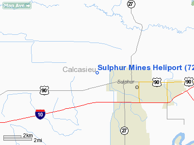
Sulphur Mines Heliport
Address:
Calcasieu Parish, LA
Tel:
504-734-4200,
318-527-8131
Images
and information placed above are from
http://www.airport-data.com/airport/72LA/
We
thank them for the data!
|
General Info |
| Country |
United
States |
| State |
LOUISIANA |
| FAA ID |
72LA
|
| Latitude |
30-14-45.738N |
|
Longitude |
093-24-30.563W |
|
Elevation |
15 feet
|
| Near
City |
SULPHUR
|
We don't guarantee the information is fresh and accurate. The data may
be wrong or outdated.
For more up-to-date information please refer to other sources.
|
|


