 |
|
Location &
QuickFacts
|
FAA
Information Effective: |
2008-09-25 |
|
Airport
Identifier: |
LA51 |
|
Airport
Status: |
Operational |
|
Longitude/Latitude: |
093-25-50.6290W/32-01-05.5820N
-93.430730/32.018217 (Estimated) |
|
Elevation: |
130 ft / 39.62 m (Estimated) |
|
Land: |
0 acres |
|
From
nearest city: |
4 nautical miles W of Coushatta, LA |
|
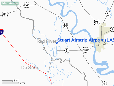
Location: |
Red River Parish, LA |
|
Magnetic Variation: |
05E (1985) |
Owner & Manager
|
Ownership: |
Privately owned |
|
Owner: |
John G Stuart |
|
Address: |
1029 Clarkson Street
Coushatta, LA 71019 |
|
Address: |
|
Airport Operations and Facilities
|
Airport Use: |
Private |
|
Wind indicator: |
No |
|
Segmented Circle: |
No |
|
Control Tower: |
No |
|
Landing fee charge: |
No |
|
Sectional chart: |
Memphis |
|
Region: |
ASW - Southwest |
|
Boundary ARTCC: |
ZFW - Fort Worth |
|
Tie-in FSS: |
DRI - De Ridder |
|
FSS on Airport: |
No |
|
FSS Toll Free: |
1-800-WX-BRIEF |
Airport Services
|
Fuel
available: |
80 |
|
Airframe
Repair: |
NONE |
|
Power
Plant Repair: |
MAJOR |
|
Runway Information
Runway N/S
|
Dimension: |
1500 x 100 ft / 457.2 x 30.5 m |
|
Surface: |
TURF, |
|
|
Runway N |
Runway S |
|
Traffic
Pattern: |
Left |
Left |
|
Radio Navigation Aids
|
ID |
Type |
Name |
Ch |
Freq |
Var |
Dist |
|
MSD |
NDB |
Mansfield |
|
414.00 |
04E |
17.2 nm |
|
MMY |
NDB |
Many |
|
272.00 |
04E |
27.5 nm |
|
IE |
NDB |
Campi |
|
407.00 |
04E |
28.2 nm |
|
JBL |
NDB |
Hodge |
|
256.00 |
04E |
37.5 nm |
|
MNE |
NDB |
Minden |
|
201.00 |
04E |
38.0 nm |
|
CZJ |
NDB |
Amason |
|
341.00 |
04E |
38.5 nm |
|
IFJ |
NDB |
Winnfield |
|
402.00 |
04E |
39.6 nm |
|
RPF |
NDB |
Carthage |
|
332.00 |
04E |
45.1 nm |
|
TUF |
NDB |
Stuckey |
|
350.00 |
03E |
48.8 nm |
|
BAD |
TACAN |
Barksdale |
105X |
|
05E |
31.6 nm |
|
DTN |
VOR |
Downtown |
|
108.60 |
07E |
35.1 nm |
|
SWB |
VOR/DME |
Sawmill |
84Y |
113.75 |
02E |
38.5 nm |
|
EMG |
VORTAC |
Elm Grove |
049X |
111.20 |
07E |
24.4 nm |
|
EIC |
VORTAC |
Belcher |
121X |
117.40 |
07E |
49.2 nm |
|
SHV |
VOT |
Shreveport Regional |
|
108.20 |
|
41.3 nm |
Based Aircraft
|
Aircraft based
on field: |
3 |
|
Single Engine
Airplanes: |
3 |
Stuart Airstrip Airport
Address:
Red River Parish, LA
Tel:
Images
and information placed above are from
http://www.airport-data.com/airport/LA51/
We
thank them for the data!
|
General Info |
| Country |
United
States |
| State |
LOUISIANA |
| FAA ID |
LA51
|
| Latitude |
32-01-05.582N |
|
Longitude |
093-25-50.629W |
|
Elevation |
130 feet
|
| Near
City |
COUSHATTA |
We don't guarantee the information is fresh and accurate. The data may
be wrong or outdated.
For more up-to-date information please refer to other sources.
|
|


