 |
|
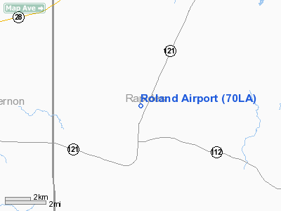
Location &
QuickFacts
|
FAA
Information Effective: |
2008-09-25 |
|
Airport
Identifier: |
70LA |
|
Airport
Status: |
Operational |
|
Longitude/Latitude: |
092-45-22.5320W/31-10-08.6620N
-92.756259/31.169073 (Estimated) |
|
Elevation: |
220 ft / 67.06 m (Estimated) |
|
Land: |
0 acres |
|
From
nearest city: |
1 nautical miles N of Hineston, LA |
|
Location: |
Rapides Parish, LA |
|
Magnetic Variation: |
04E (1990) |
Owner & Manager
|
Ownership: |
Privately owned |
|
Owner: |
W. D. Roland, Jr. |
|
Address: |
P.o. Box 5465
Alexandria, LA 71307 |
|
Phone
number: |
318-442-7783 |
|
Manager: |
W. D. Roland, Jr. |
|
Address: |
P.o. Box 5465
Alexandria, LA 71307 |
|
Phone number: |
318-442-7783 |
Airport Operations and Facilities
|
Airport
Use: |
Private |
|
Wind
indicator: |
Yes |
|
Segmented Circle: |
Yes |
|
Control
Tower: |
No |
|
Sectional chart: |
Houston |
|
Region: |
ASW - Southwest |
|
Boundary
ARTCC: |
ZHU - Houston |
|
Tie-in
FSS: |
DRI - De Ridder |
|
FSS on
Airport: |
No |
|
FSS Toll
Free: |
1-800-WX-BRIEF |
|
Runway Information
Runway 09/27
|
Dimension: |
2500 x 200 ft / 762.0 x 61.0 m |
|
Surface: |
TURF, |
|
|
Runway 09
|
Runway 27
|
|
Traffic
Pattern: |
Right |
Left |
|
Displaced
threshold: |
0.00 ft |
740.00 ft |
|
Radio Navigation Aids
|
ID |
Type |
Name |
Ch |
Freq |
Var |
Dist |
|
POE |
FAN MARKER |
South |
|
|
07E |
23.9 nm |
|
POE1 |
FAN MARKER |
North |
|
|
07E |
24.1 nm |
|
GUV |
NDB |
Gator |
|
359.00 |
05E |
23.6 nm |
|
VED |
NDB |
Leesville |
|
247.00 |
04E |
30.4 nm |
|
LRR |
NDB |
Allen Parish |
|
379.00 |
03E |
31.9 nm |
|
BWK |
NDB |
Bunkie |
|
397.00 |
03E |
32.5 nm |
|
IE |
NDB |
Campi |
|
407.00 |
04E |
33.7 nm |
|
MKV |
NDB |
Marksville |
|
347.00 |
02E |
35.5 nm |
|
DR |
NDB |
Idder |
|
385.00 |
04E |
38.9 nm |
|
ECY |
NDB |
Eunice |
|
263.00 |
02E |
39.9 nm |
|
OPL |
NDB |
St Landry |
|
335.00 |
04E |
45.9 nm |
|
MMY |
NDB |
Many |
|
272.00 |
04E |
47.0 nm |
|
IFJ |
NDB |
Winnfield |
|
402.00 |
04E |
48.0 nm |
|
SWB |
VOR/DME |
Sawmill |
84Y |
113.75 |
02E |
48.5 nm |
|
AEX |
VORTAC |
Alexandria |
108X |
116.10 |
03E |
14.1 nm |
|
FXU |
VORTAC |
Polk |
021X |
108.40 |
05E |
24.0 nm |
Remarks
-
PRVDD TFC
PATTERNS ARE RSTRD TO THE SOUTH OF EAST/WEST RY & TFC PATTERNS ARE RSTRD TO
THE WEST OF NORTH/SOUTH RY.
Based Aircraft
|
Aircraft based
on field: |
2 |
|
Single Engine
Airplanes: |
1 |
|
Ultralights: |
1 |
Roland Airport
Address:
Rapides Parish, LA
Tel:
318-442-7783
Images
and information placed above are from
http://www.airport-data.com/airport/70LA/
We
thank them for the data!
|
General Info |
| Country |
United
States |
| State |
LOUISIANA |
| FAA ID |
70LA
|
| Latitude |
31-10-08.662N |
|
Longitude |
092-45-22.532W |
|
Elevation |
220 feet
|
| Near
City |
HINESTON
|
We don't guarantee the information is fresh and accurate. The data may
be wrong or outdated.
For more up-to-date information please refer to other sources.
|
|


