 |
|
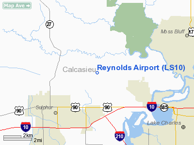
Location &
QuickFacts
|
FAA
Information Effective: |
2008-09-25 |
|
Airport
Identifier: |
LS10 |
|
Airport
Status: |
Operational |
|
Longitude/Latitude: |
093-18-42.5600W/30-16-19.7350N
-93.311822/30.272149 (Estimated) |
|
Elevation: |
20 ft / 6.10 m (Estimated) |
|
Land: |
0 acres |
|
From
nearest city: |
3 nautical miles SE of Westlake, LA |
|
Location: |
Calcasieu Parish, LA |
|
Magnetic Variation: |
05E (1985) |
Owner & Manager
|
Ownership: |
Privately owned |
|
Owner: |
J. H. Reynolds |
|
Address: |
9517 Teche Way
Shreveport, LA 71118 |
|
Phone number: |
318-687-6609 |
|
Manager: |
J.h. Reynolds |
|
Address: |
9517 Teche Way
Shreveport, LA 71118 |
|
Phone number: |
318-687-6609 |
Airport Operations and Facilities
|
Airport Use: |
Private |
|
Segmented Circle: |
No |
|
Control Tower: |
No |
|
Landing fee charge: |
No |
|
Sectional chart: |
Houston |
|
Region: |
ASW - Southwest |
|
Boundary ARTCC: |
ZHU - Houston |
|
Tie-in FSS: |
DRI - De Ridder |
|
FSS on Airport: |
No |
|
FSS Toll Free: |
1-800-WX-BRIEF |
Airport Services
|
Runway Information
Runway 16/34
|
Dimension: |
2000 x 40 ft / 609.6 x 12.2 m |
|
Surface: |
TURF, |
|
|
Runway 16
|
Runway 34
|
|
Traffic
Pattern: |
Left |
Left |
|
Radio Navigation Aids
|
ID |
Type |
Name |
Ch |
Freq |
Var |
Dist |
|
POE |
FAN MARKER |
South |
|
|
07E |
43.1 nm |
|
UX |
NDB |
Sulfy |
|
278.00 |
04E |
7.2 nm |
|
DQU |
NDB |
De Quincy |
|
410.00 |
05E |
12.7 nm |
|
ORG |
NDB |
Orange |
|
211.00 |
05E |
27.9 nm |
|
DR |
NDB |
Idder |
|
385.00 |
04E |
28.9 nm |
|
LRR |
NDB |
Allen Parish |
|
379.00 |
03E |
39.2 nm |
|
GUV |
NDB |
Gator |
|
359.00 |
05E |
45.9 nm |
|
GDE |
NDB |
Goodhue |
|
368.00 |
07E |
47.9 nm |
|
ECY |
NDB |
Eunice |
|
263.00 |
02E |
48.0 nm |
|
HRD |
NDB |
Hardin County |
|
524.00 |
04E |
49.4 nm |
|
VED |
NDB |
Leesville |
|
247.00 |
04E |
49.9 nm |
|
BPT |
VOR/DME |
Beaumont |
092X |
114.50 |
07E |
41.5 nm |
|
LCH |
VORTAC |
Lake Charles |
081X |
113.40 |
07E |
13.3 nm |
Remarks
-
ARPT NOT
MAINTAINED--UNSAFE TO USE.
-
PRVDD THRS ARE
DSPLCD TO PROVIDE 20:1 APCH SLOPE.
Based Aircraft
|
Aircraft based
on field: |
4 |
|
Ultralights: |
4 |
Reynolds Airport
Address:
Calcasieu Parish, LA
Tel:
318-687-6609
Images
and information placed above are from
http://www.airport-data.com/airport/LS10/
We
thank them for the data!
|
General Info |
| Country |
United
States |
| State |
LOUISIANA |
| FAA ID |
LS10
|
| Latitude |
30-16-19.735N |
|
Longitude |
093-18-42.560W |
|
Elevation |
20 feet
|
| Near
City |
WESTLAKE
|
We don't guarantee the information is fresh and accurate. The data may
be wrong or outdated.
For more up-to-date information please refer to other sources.
|
|


