 |
|
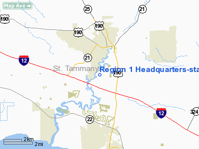
Region 1 Headquarters-state Police Heliport |
Location &
QuickFacts
|
FAA
Information Effective: |
2008-09-25 |
|
Airport
Identifier: |
19LA |
|
Airport
Status: |
Operational |
|
Longitude/Latitude: |
090-06-11.2780W/30-26-51.6940N
-90.103133/30.447693 (Estimated) |
|
Elevation: |
70 ft / 21.34 m (Estimated) |
|
Land: |
0 acres |
|
From
nearest city: |
0 nautical miles SE of Baton Rouge, LA |
|
Location: |
East Baton Rouge Parish, LA |
|
Magnetic Variation: |
03E (1985) |
Owner & Manager
|
Ownership: |
Publicly owned |
|
Owner: |
La State Police |
|
Address: |
7919 Independence Blvd A-1
Baton Rouge, LA 70806 |
|
Phone
number: |
225-922-0380 |
|
Manager: |
Brett Mc Cloud |
|
Address: |
7919 Independence Blvd A-1
Baton Rouge, LA 70806 |
|
Phone number: |
225-922-0380 |
Airport Operations and Facilities
|
Airport
Use: |
Private |
|
Wind
indicator: |
Yes |
|
Segmented Circle: |
No |
|
Control
Tower: |
No |
|
Landing
fee charge: |
No |
|
Sectional chart: |
New Orleans |
|
Region: |
ASW - Southwest |
|
Boundary
ARTCC: |
ZHU - Houston |
|
Tie-in
FSS: |
DRI - De Ridder |
|
FSS on
Airport: |
No |
|
FSS Toll
Free: |
1-800-WX-BRIEF |
|
Runway Information
Helipad H1
|
Dimension: |
20 x 20 ft / 6.1 x 6.1 m |
|
Surface: |
CONC, |
|
|
Runway H1
|
Runway
|
|
Traffic
Pattern: |
Left |
Left |
|
Radio Navigation Aids
|
ID |
Type |
Name |
Ch |
Freq |
Var |
Dist |
|
FNA |
NDB |
Florenville |
|
371.00 |
03E |
14.8 nm |
|
DEF |
NDB |
Slidell |
|
256.00 |
03E |
16.6 nm |
|
MJD |
NDB |
Picayune |
|
276.00 |
01E |
23.5 nm |
|
BX |
NDB |
Carma |
|
353.00 |
02E |
28.9 nm |
|
MS |
NDB |
Kinte |
|
338.00 |
03E |
29.7 nm |
|
AYI |
NDB |
Hanco |
|
221.00 |
03E |
33.6 nm |
|
HS |
NDB |
Hanco |
|
221.00 |
01E |
33.6 nm |
|
HMU |
VOR |
Hammond |
|
109.60 |
03E |
16.8 nm |
|
PCU |
VOR/DME |
Picayune |
059X |
112.20 |
05E |
20.5 nm |
|
RQR |
VOR/DME |
Reserve |
045X |
110.80 |
02E |
33.2 nm |
|
HRV |
VORTAC |
Harvey |
088X |
114.10 |
02E |
36.3 nm |
|
NEW |
VOT |
New Orleans Lakefront |
|
111.00 |
|
24.8 nm |
Remarks
-
E111: PRVDD APCH
SLOPES TO LNDG AREA ARE MAINTAINED IN ACCORDANCE WITH PART 77 OF THE FEDERAL
AVIATION REGULATIONS.
Based Aircraft
|
Aircraft based
on field: |
1 |
|
Helicopters: |
1 |
Region 1 Headquarters-state Police Heliport
Address:
East Baton Rouge Parish, LA
Tel:
225-922-0380
Images
and information placed above are from
http://www.airport-data.com/airport/19LA/
We
thank them for the data!
|
General Info |
| Country |
United
States |
| State |
LOUISIANA |
| FAA ID |
19LA
|
| Latitude |
30-26-51.694N |
|
Longitude |
090-06-11.278W |
|
Elevation |
70 feet
|
| Near
City |
BATON
ROUGE |
We don't guarantee the information is fresh and accurate. The data may
be wrong or outdated.
For more up-to-date information please refer to other sources.
|
|


