 |
|
Rapides Regional Medical Center Hospital Heliport |
|
|
Location &
QuickFacts
|
FAA
Information Effective: |
2008-09-25 |
|
Airport
Identifier: |
LS27 |
|
Airport
Status: |
Operational |
|
Longitude/Latitude: |
092-27-01.0000W/31-18-06.0000N
-92.450278/31.301667 (Estimated) |
|
Elevation: |
125 ft / 38.10 m (Estimated) |
|
Land: |
0 acres |
|
From
nearest city: |
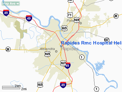
1 nautical miles NE of Alexandria, LA |
|
Location: |
Rapides Parish, LA |
|
Magnetic Variation: |
04E (1985) |
Owner & Manager
|
Ownership: |
Privately owned |
|
Owner: |
Rapides Regional Medical Center |
|
Address: |
211 Fourth Street
Alexandria, LA 71301 |
|
Phone
number: |
318-441-2287 |
|
Manager: |
Evan Hall C/o Air Med 4 |
|
Address: |
211 Fourth Street
Alexandria, LA 71301 |
|
Phone number: |
318-449-7670 |
Airport Operations and Facilities
|
Airport Use: |
Private
MEDICAL. |
|
Wind indicator: |
Yes |
|
Segmented Circle: |
No |
|
Control Tower: |
No |
|
Lighting Schedule: |
DUSK-DAWN |
|
Beacon Color: |
Clear-Green-Yellow (heliport) |
|
Sectional chart: |
Houston |
|
Region: |
ASW - Southwest |
|
Boundary ARTCC: |
ZHU - Houston |
|
Tie-in FSS: |
DRI - De Ridder |
|
FSS Toll Free: |
1-800-WX-BRIEF |
Airport
Communications
|
Runway Information
Helipad H1
|
Dimension: |
60 x 60 ft / 18.3 x 18.3 m |
|
Surface: |
CONC, Good Condition |
|
|
Runway H1
|
Runway
|
|
Traffic
Pattern: |
Left |
Left |
|
Radio Navigation Aids
|
ID |
Type |
Name |
Ch |
Freq |
Var |
Dist |
|
POE1 |
FAN MARKER |
North |
|
|
07E |
41.2 nm |
|
POE |
FAN MARKER |
South |
|
|
07E |
41.5 nm |
|
MKV |
NDB |
Marksville |
|
347.00 |
02E |
23.0 nm |
|
BWK |
NDB |
Bunkie |
|
397.00 |
03E |
28.5 nm |
|
IE |
NDB |
Campi |
|
407.00 |
04E |
38.6 nm |
|
IFJ |
NDB |
Winnfield |
|
402.00 |
04E |
41.1 nm |
|
GUV |
NDB |
Gator |
|
359.00 |
05E |
41.2 nm |
|
LRR |
NDB |
Allen Parish |
|
379.00 |
03E |
41.6 nm |
|
OPL |
NDB |
St Landry |
|
335.00 |
04E |
42.9 nm |
|
ECY |
NDB |
Eunice |
|
263.00 |
02E |
44.6 nm |
|
VED |
NDB |
Leesville |
|
247.00 |
04E |
47.4 nm |
|
SWB |
VOR/DME |
Sawmill |
84Y |
113.75 |
02E |
42.0 nm |
|
AEX |
VORTAC |
Alexandria |
108X |
116.10 |
03E |
3.8 nm |
|
FXU |
VORTAC |
Polk |
021X |
108.40 |
05E |
41.1 nm |
Based Aircraft
|
Aircraft based
on field: |
1 |
|
Helicopters: |
1 |
Rapides Regional Medical Center Hospital
Heliport
Address:
Rapides Parish, LA
Tel:
318-441-2287,
318-449-7670
Images
and information placed above are from
http://www.airport-data.com/airport/LS27/
We
thank them for the data!
|
General Info |
| Country |
United
States |
| State |
LOUISIANA |
| FAA ID |
LS27
|
| Latitude |
31-18-06.000N |
|
Longitude |
092-27-01.000W |
|
Elevation |
125 feet
|
| Near
City |
ALEXANDRIA |
We don't guarantee the information is fresh and accurate. The data may
be wrong or outdated.
For more up-to-date information please refer to other sources.
|
|


