 |
|
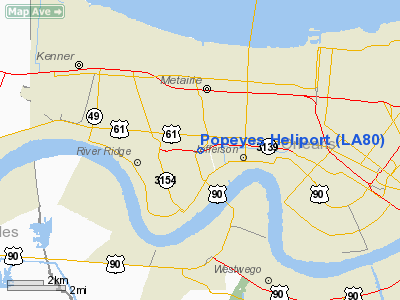
Location &
QuickFacts
|
FAA
Information Effective: |
2008-09-25 |
|
Airport
Identifier: |
LA80 |
|
Airport
Status: |
Operational |
|
Longitude/Latitude: |
090-10-56.2700W/29-58-05.7340N
-90.182297/29.968259 (Estimated) |
|
Elevation: |
6 ft / 1.83 m (Estimated) |
|
Land: |
0 acres |
|
From
nearest city: |
5 nautical miles N of New Orleans, LA |
|
Location: |
Jefferson Parish, LA |
|
Magnetic Variation: |
03E (1985) |
Owner & Manager
|
Ownership: |
Privately owned |
|
Owner: |
Al Copeland Enterprises, Inc |
|
Address: |
1333 S. Clearview Pkwy
Jefferson, LA 70121 |
|
Phone
number: |
504-733-4300 |
|
Manager: |
Steven H. Blair, Chief Pilot
DIRECTOR OF MAINTENANCE |
|
Address: |
1122 E. Lakeshore Drive
Carriere, MS 39426 |
|
Phone number: |
601-798-7413 |
Airport Operations and Facilities
|
Airport
Use: |
Private |
|
Segmented Circle: |
No |
|
Control
Tower: |
No |
|
Sectional chart: |
New Orleans |
|
Region: |
ASW - Southwest |
|
Boundary
ARTCC: |
ZHU - Houston |
|
Tie-in
FSS: |
DRI - De Ridder |
|
FSS on
Airport: |
No |
|
FSS Toll
Free: |
1-800-WX-BRIEF |
|
Runway Information
Helipad H1
|
Dimension: |
50 x 50 ft / 15.2 x 15.2 m |
|
Surface: |
CONC, |
|
|
Runway H1
|
Runway
|
|
Traffic
Pattern: |
Left |
Left |
|
Radio Navigation Aids
|
ID |
Type |
Name |
Ch |
Freq |
Var |
Dist |
|
MS |
NDB |
Kinte |
|
338.00 |
03E |
11.8 nm |
|
DEF |
NDB |
Slidell |
|
256.00 |
03E |
26.8 nm |
|
FNA |
NDB |
Florenville |
|
371.00 |
03E |
32.8 nm |
|
MJD |
NDB |
Picayune |
|
276.00 |
01E |
41.9 nm |
|
AYI |
NDB |
Hanco |
|
221.00 |
03E |
47.6 nm |
|
HS |
NDB |
Hanco |
|
221.00 |
01E |
47.6 nm |
|
HMU |
VOR |
Hammond |
|
109.60 |
03E |
35.3 nm |
|
RQR |
VOR/DME |
Reserve |
045X |
110.80 |
02E |
22.3 nm |
|
PCU |
VOR/DME |
Picayune |
059X |
112.20 |
05E |
42.7 nm |
|
HRV |
VORTAC |
Harvey |
088X |
114.10 |
02E |
11.7 nm |
|
TBD |
VORTAC |
Tibby |
057X |
112.00 |
02E |
38.4 nm |
|
LEV |
VORTAC |
Leeville |
082X |
113.50 |
02E |
47.8 nm |
|
NEW |
VOT |
New Orleans Lakefront |
|
111.00 |
|
9.2 nm |
Based Aircraft
|
Aircraft based
on field: |
1 |
|
Helicopters: |
1 |
Popeyes Heliport
Address:
Jefferson Parish, LA
Tel:
504-733-4300,
601-798-7413
Images
and information placed above are from
http://www.airport-data.com/airport/LA80/
We
thank them for the data!
|
General Info |
| Country |
United
States |
| State |
LOUISIANA |
| FAA ID |
LA80
|
| Latitude |
29-58-05.734N |
|
Longitude |
090-10-56.270W |
|
Elevation |
6 feet
|
| Near
City |
NEW
ORLEANS |
We don't guarantee the information is fresh and accurate. The data may
be wrong or outdated.
For more up-to-date information please refer to other sources.
|
|


