 |
|
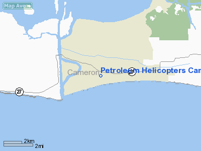
Petroleum Helicopters Cameron Heliport |
|
|
Location &
QuickFacts
|
FAA
Information Effective: |
2008-09-25 |
|
Airport
Identifier: |
7LA5 |
|
Airport
Status: |
Operational |
|
Longitude/Latitude: |
093-18-00.5510W/29-47-00.7970N
-93.300153/29.783555 (Estimated) |
|
Elevation: |
3 ft / 0.91 m (Estimated) |
|
Land: |
12 acres |
|
From
nearest city: |
1 nautical miles SE of Cameron, LA |
|
Location: |
Cameron Parish, LA |
|
Magnetic Variation: |
05E (1985) |
Owner & Manager
|
Ownership: |
Privately owned |
|
Owner: |
Petroleum Helicopters |
|
Address: |
Po Box 386
Cameron, LA 70631 |
|
Phone number: |
318-775-7157 |
|
Manager: |
Ray Hecker |
|
Address: |
Box 386
Cameron, LA 70631 |
|
Phone number: |
318-775-7157
LFT OFFICE 318-235-2453 |
Airport Operations and Facilities
|
Airport Use: |
Private |
|
Wind indicator: |
Yes |
|
Segmented Circle: |
No |
|
Control Tower: |
No |
|
Landing fee charge: |
No |
|
Sectional chart: |
Houston |
|
Region: |
ASW - Southwest |
|
Boundary ARTCC: |
ZHU - Houston |
|
Tie-in FSS: |
DRI - De Ridder |
|
FSS on Airport: |
No |
|
FSS Toll Free: |
1-800-WX-BRIEF |
Airport
Communications
Airport Services
|
Airframe
Repair: |
NONE |
|
Power
Plant Repair: |
NONE |
|
Runway Information
Helipad H1
|
Dimension: |
700 x 200 ft / 213.4 x 61.0 m |
|
Surface: |
CONC-TURF, |
|
|
Runway H1
|
Runway
|
|
Traffic
Pattern: |
Left |
Left |
|
Radio Navigation Aids
|
ID |
Type |
Name |
Ch |
Freq |
Var |
Dist |
|
UX |
NDB |
Sulfy |
|
278.00 |
04E |
25.7 nm |
|
ORG |
NDB |
Orange |
|
211.00 |
05E |
31.0 nm |
|
DQU |
NDB |
De Quincy |
|
410.00 |
05E |
40.1 nm |
|
BPT |
VOR/DME |
Beaumont |
092X |
114.50 |
07E |
38.6 nm |
|
SBI |
VOR/DME |
Sabine Pass |
101X |
115.40 |
07E |
38.9 nm |
|
LLA |
VOR/DME |
White Lake |
041X |
110.40 |
04E |
48.9 nm |
|
LCH |
VORTAC |
Lake Charles |
081X |
113.40 |
07E |
23.8 nm |
Remarks
Based Aircraft
|
Aircraft based
on field: |
12 |
|
Helicopters: |
12 |
Petroleum Helicopters Cameron Heliport
Address:
Cameron Parish, LA
Tel:
318-775-7157, 318-235-2453
Images
and information placed above are from
http://www.airport-data.com/airport/7LA5/
We
thank them for the data!
|
General Info |
| Country |
United
States |
| State |
LOUISIANA |
| FAA ID |
7LA5
|
| Latitude |
29-47-00.797N |
|
Longitude |
093-18-00.551W |
|
Elevation |
3 feet
|
| Near
City |
CAMERON
|
We don't guarantee the information is fresh and accurate. The data may
be wrong or outdated.
For more up-to-date information please refer to other sources.
|
|


